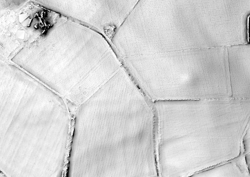
This month saw us all back working on this fascinating prehistoric site, unique in Greater Manchester (and possibly the whole of Lancashire). In fact work really started in April with a coring exercise in areas between trenches, trying to see if we could identify gaps, without having to do more digging.
Story so far –
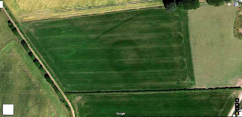
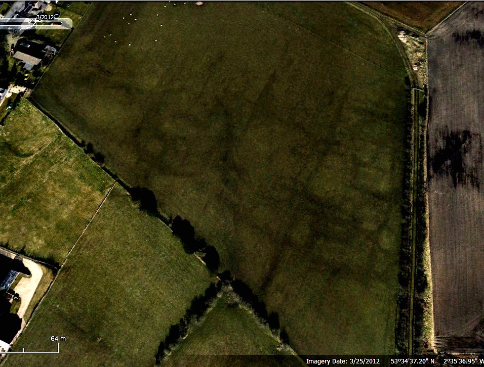
In November last year we finally got the result back from Oxford Labs from the charcoal we retrieved from the bottom Trench 1. To our surprise this came in at mid Bronze Age (1501 (95.4%) 1425calBC) – but at least it confirmed our site is prehistoric.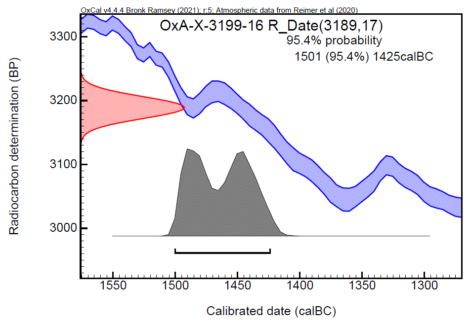 Up until then, with no other finds, we had been relying on typology, but this hadn’t been easy, as there aren’t many sites of similar size and form. Initially the central mound had suggested a Bronze Age barrow but, not being perfectly circular and having an entrance, made this unlikely. Our researches to reveal sites with similar configurations to ours known as causewayed ring ditches. A group of these in North Wales had one in particular, at Pentrehobin, with similar proportions to ours (44m diameter ditch, 4m wide by 2m deep). Another group on the Isle of Thanet in Kent was excavated in the 1970s and 80s. One, called Lord of the Manor III, even had a central mound like ours. Perhaps the closest, proportionally, to ours though is a site not far from Stonehenge called Coneybury henge.
 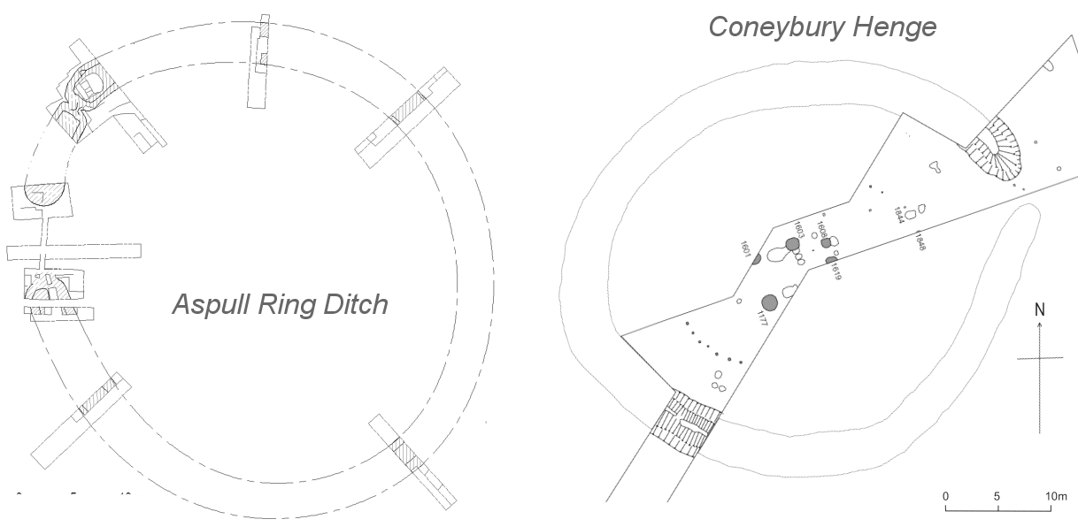 As with ours, it has no outer bank (which is assumed to have been ploughed out) but unlike ours it didn’t have a central mound. All these sites are generally dated to the late Neolithic / early Bronze Age and some contain burials, but rarely have central mounds. When these do occur, it suggests maybe a transition period when the newcomers reused the old monuments, before building their own traditional ring ditches and barrow forms. Whatever the date of its construction, there’s no denying our ring ditch is a very significant prehistoric monument, perhaps of national importance but certainly something quite unique for the region.
Towards the end of last year two more samples were sent off for testing. This time they had been retrieved from the burnt wood feature at the bottom of Trench 5. One sample went to the Chrono14 labs at Queens University Belfast, the second to CARD which a free service specifically set up for amateur groups. We have now had the results back from the former – this time the calibrated date given is between 1600 and 1700 BC. Although 100 to 200 years earlier, it’s still in the mid Bronze Age range. CARD have identified the wood species as oak which they say is less accurate than say willow which has a much shorter life span. We’re not expecting the result from CARD till later in the year.
As usual you can follow our the progress with our daily Site Diary (our current blog is here, previous year’s work here, and general project information here).