In February 2020 our attention was drawn to crop marks appearing on earlier versions Google Earth in a field in Aspull. They only appear in 2012 and 2013 but as they span over 12 months it suggests they are likely to represented something more than just agricultural activity. What is interesting about the rectilinear shapes of the crop marks is that they have all the hallmarks of a DMV (i.e. a Deserted Medieval Village). A circular feature on the left side of the field could be even be prehistoric. 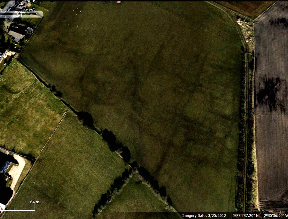 DMV sites can be found all over the country although few occur in the northwest (the nearest examples is perhaps at Tatton Park in Cheshire). Their dates can range across the whole of the early Medieval period although they are usually the result of either the plague or clearance by the lord of the manor to create a park (as was the case at Tatton).
Corvid has effected or field operations but lockdown restrictions are beginning to ease so, being eager to get back into the field, we started our survey of the site earlier this month. You can find out how we got on here.
The Wigan Archaeological Society
Project Blog

Couldn’t comment on the page I was most interested in, but just wanted to say that I love and appreciate your site: keep up the good work! For those of us expatriates from the North West (I live in Oxfordshire these days) it’s nice to see the industrial archeology of the old place carrying on.
Thanks Dan for your feedback and support