This site archive cover the period from 2012 to 2013 when we returned to Area 1 investigate some unanswered questions form our initial work there. First question was whether the cast iron pipe running under the south edge of the road continued under the concrete. The second question was whether the deep trench running on the north side of the road also continued under the concrete. Towards the end of the period one of the original entrance gateposts turned, we therefore turned our attention to this (here is a detailed blog of our activities there).
——
Date: August 9th, 2013
The ditch seemed to get deeper towards the south-west side. The likelihood is that it was a drainage ditch (could it be draining a moat which is located further up).

Excavating down the side of the gatepost discovered the week revealed more courses but not much sign of a road.

Date: August 2nd,2013
Digging out the blue-grey material showed that it was the fill of a vee-shaped ditch. Not many finds in the fill to establish a date either – just some pieces of cannel coal but some small pieces of wood may gives us a carbon date (if we could afford it). Drawing the section didn’t take too long and emphasized to us that the ditch had been truncated and back filled with the hard compacted material. 

Whilst packing up we noticed stonework protruding through the undergrowth near to where I park my car. Quickly clearing it revealed it to be the remnant of the gatepost associated with the previous hall. This is a great find (strange we hadn’t noticed before). There was also curbing attached but not quite on the same alignment as the current track.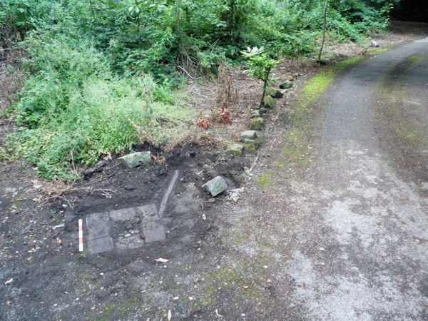

Date: July 7th,2013
Our hopes of finding evidence of the moat have been dashed by our latest visit. We’ve taken back the hard surface revealing that the sandy-clay patch, which lies underneath, extends all the way to the back of the trench – proving quite convincingly that this is the natural substrata. The dark bluey-grey material only exists as a narrow band which is hardly moat-sized.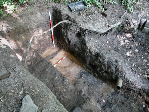

Date: June 16th, 2013
This week we were able to extend the trench another 15cm (30cm in total for this month – progress is slow because of the depth) uncovering more of the hard surface. Also removed the small cast iron pipe, which supplied the water feature, making access much easier (but we left the field drain in situ for the time being).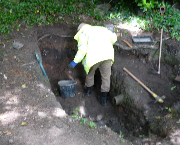 Banding in the overburden suggests different periods of activity (or maybe just one, filling from different sources) – difficult to tell with scarcity of finds. However whole bricks found near the bottom, resting almost on top of the hard surface, suggest not a long period between top and bottom of the overburden.
 The middle band in the overburden is rich in building rubble – particularly mortar Next visit we will cut back the hard surface (in the area of the vertical measuring stick) – it is still producing 17th/18th C pottery. The idea is to see if our potential moat feature extends beyond the sandy-clay patch.
 Banding in the overburden suggests different periods of activity (or maybe just one, filling from different sources) – difficult to tell with scarcity of finds. However whole bricks found near the bottom, resting almost on top of the hard surface, suggest not a long period between top and bottom of the overburden.
 The middle band in the overburden is rich in building rubble – particularly mortar Next visit we will cut back the hard surface (in the area of the vertical measuring stick) – it is still producing 17th/18th C pottery. The idea is to see if our potential moat feature extends beyond the sandy-clay patch.
Date: June 7, 2013
Last year, after recording the pipe feature, we back filled this part of the trench to prevent it filling with water over winter. We didn’t however back fill the area under the water feature where he had detected the cobbled surface. Surprisingly, after a very wet 9 months, the cut had survived quite well over the winter months. We managed to clear the debris from the bottom of the trench quite quickly revealing the bluey-grey surface of the supposed moat we had uncovered in July last year. Also revealed was the sandy-clay patch which made us suspect that maybe it wasn’t the moat. With the limited time we had (this was the first time we had been on site on Friday afternoon) we managed to extend the trench northwards by about 15cm revealing more of the hard cobbled surface. Next visit we extend it further in this direction.
—
Date: October 21,2012
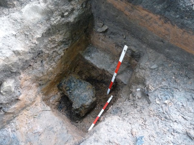
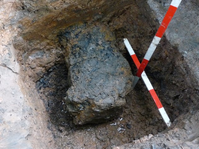
Mystery solved – the black thing lurking at the bottom of the deep trench turns out to be a cast iron pipe. It has an internal diameter of 150mm (6 inch) and has a flange on the end (not a cannon after all).
The large plate on the end of the pipe was in fact a flat stone which had adhered itself to the flange forming an effective seal. When this was removed the interior of the pipe was revealed. Still no indication of its use though and why it finishes just as it emerges from under the concrete – the only explanation is that the rest of it was salvaged at some point after the concrete had been laid, thus making this section almost irretrievable.
We recapped the pipe (with the same stone) and back-filled, and as we did we took the opportunity to expand the trench northwards as far as we could. This was to expose more of the bluey-grey feature we had discovered under the compacted brown layer. This reveals that the vee shaped cut in the natural carries on going for at least 60cm (2 feet) making it even more promising – (it may or may not be the moat but if we could prove that it is, surely this would be a very significant find for the Society).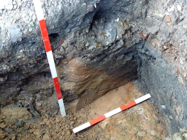

Date: September 9, 2012
Forgot to mention on our last visit we detected something lurking at the bottom of the deep trench. It was hard and black and worryingly water was oozing from it. This Sunday we managed to expose the feature. It turned out to be a large iron lump but still not sure exactly what it is. Thankfully however the water issuing from it eventually stopped suggesting that it wasn’t a live main.
What is difficult to understand is why it stops just after it emerges from under the concrete (the deep trench continues for at least another 1.5 metres). After removing the large stone lying in front of it we could see the full extent of its depth (if you’re thinking it looks like the end of a cannon you’re not on your own).
The very end seems to be capped off with a large plate which is deeper than the main body. It also seems to be sitting on a rotted piece of wood (Andy reckons it’s the gun carriage). Interestingly out of the wood came square-section hand-made nails (if it is a cannon then we would have to tunnel under the concrete to get it out)..
Date: July 29, 2012
Cutting through the cobble surface proved very difficult suggesting that it most likely had been purposely made either as a road or a foundation for something. As expected, underneath the surface was the blue grey fill we had discovered in the adjacent trench – but disappointingly it seems only to be localised to the front part of the trench, turning to clayey sand towards the back end of the trench. This suggests that the ditch may not be the filled-in moat we’re looking for – however the sand may also be a localised fill. To unravel the mystery we will need to expand the trench northwards but this may prove difficult due to the rising ground in this area.
Date: June 26, 2012 11:21PM
Comparing the two trenches it’s obvious the cobble surface is higher than the ‘V’ shaped ditch – so hopefully evidence of the ditch still survives underneath. Note the field-drain sections to right of the photo which have been removed from both trenches. The new ditch feature could be related the previous ditch we discovered in 2010 as it’s at the same level and similar colour – although difficult to establish because of the deep trench cutting through them both.

Date: June 26, 2012 11:01PM
Cleaning this trench down to the previously exposed level shows that the cobble surface spreads all across. It would make a great road surface except that its too uneven (maybe over time subsidence has cause the humps and hollows to appear). There are a couple of places where cobbles are missing though and the ground is soft in these areas – could be pot-holes. By the way the stone sets on the right of the photo were put down to form a more solid platform to stand on (this is where the deep trench is).

Date: June 12, 2012 10:41PM
On further inspection it is obvious the cut with the blue grey fill, starts higher up and includes the compacted dark brown layer (actually the cut seems to be vee shaped). To investigated this further we decided to re-excavate the area where the water feature was (which we had previously back filled). We soon reached the compacted dark brown layer but at a higher level and again it was full of pre-Victorian pottery and bone (including pieces of a cream-ware pot with an interesting basket pattern).

Date: April 21, 2012 11:09AM
This view shows almost the complete story – on the left is the deep trench which cuts through the dirt track and sand layer (the remnant of which can be seen on the top right). The deep trench has been cut into to insert the field drain (in centre of the picture). Also in the centre of the picture is the orange of the natural clay. On the right is the thick layer of hard brown compacted material which overlays the cut with the soft dark bluey grey material in it. It’s early days but the cut feature must be older than the hard brown compacted layer (which we think is 16th/17th century).

Date: April 21, 2012 10:35AM
As we dug further north we discovered that the hard compacted sand merges into the same hard brown compacted layer that we came across under the water feature. This layer is full of 17th/18th century pottery, bits of iron and (again) large pieces of cow bone. However what is particularly exciting is that underneath this deep layer is a cut, and this cut filled with a soft dark bluey grey material – the type of material usually resulting from stagnant water. We’ve only uncovered the edge of this cut but can we dare to say that finally we have discovered the moat?

Date: April 21, 2012 09:25AM
We removed the field drain to check if the concrete goes under it (difficult to confirm though as the concrete merges into hard compacted sand in this area). However the other edge of the deep trench is now exposed clearly showing its extent and that it definitely goes under the concrete (slightly narrowing as it does).

Date: April 12, 2012 11:11PM
We also managed to solve the issue of the field drain which obviously detours around the concrete (showing that it’s a later addition). Looks like this is the extent of the concrete on this side but it may follow the line of the drain making it extend further (impossible to check due to restriction of the nearby tree).

Date: April 12, 2012 10:53PM
Further digging here revealed what we were looking for. Difficult to see but underneath the concrete the clay is in two halves. On the right is pure clay but on the left is loose gritty mix from the backfill of the deep trench – showing that it was dug and back filled before the concrete was put down. This puts it in a narrow time frame between the creation of the dirt track and the laying down of the concrete (still don’t know why though).

Date: March 23, 2012 08:43PM
On the north side of the road, there is also the question of what happens to the deep trench when it reaches the concrete (does it go underneath – making it older or not). Digging out this area shows that the concrete is deeper than the road – deeper even than the underlying bed of sand, cutting into the dark brown layer below it. In fact it stretches almost to the bottom of the trench we dug – obviously further work needed here to determine the relationship between the deep trench and the concrete. (Note the stone blocks on the left were placed there temporarily to hold back the backfill while we dug the trench.)

Date: March 23, 2012 08:06PM
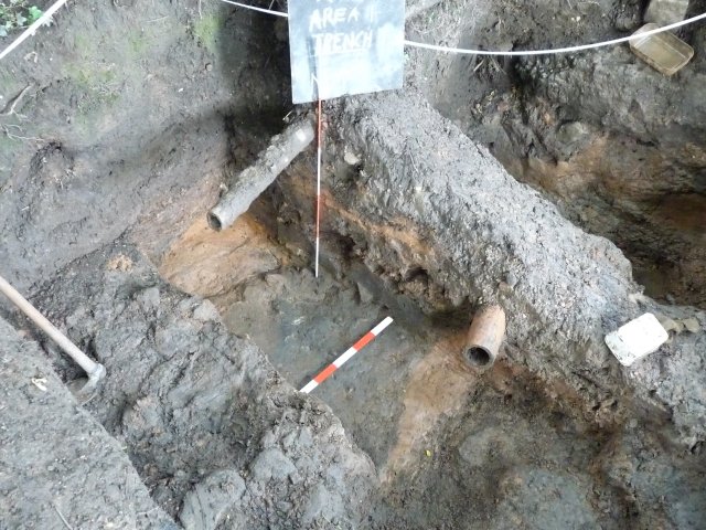
Restarting excavations at the Rectory after the Christmas break meant time for backfill – including the trenches in area 1 (we haven’t worked in this area since July last year). But before we complete the back filling, there’s opportunity to check out a couple of unanswered questions. First is the issue of whether the large cast iron pipe under the south side edge of the road goes under the concrete or not. This trench across the interface of the concrete and dirt track/road shows that is does.


I would like to have a picture of the corner stone of Gidlow Hall that shows the 1574 (?) date and Thomas Gidlow’s initials. I have been unable to learn the names of the current owners nor gain access to the property when I was in Aspull in 2010. Please let me know and where is the pottery pieces that have been found in the moat? Thanx
Hi Roy,
Haven’t been up there for a while but do have some pictures which I will send shortly. We haven’t much information about this fascinating hall so would be most interested in anything you have been able to discover (it’s one of only two in the Wigan area with its moat still intact).
Bill Aldridge
(secretary)