
Date: Wednesday 10th December 2025
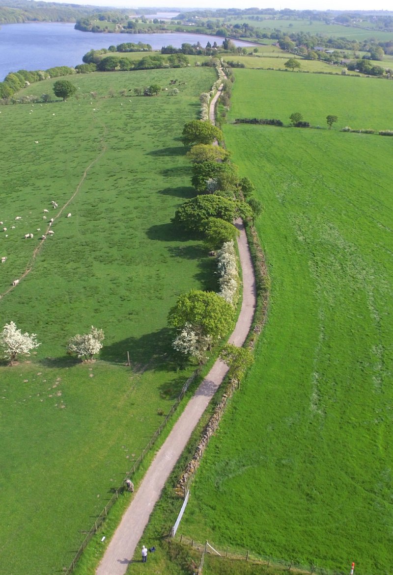
Taking advantage of a break in the weather, I contacted Paul Ashcroft who works for United Utilities, to arrange a trip up onto the Nab. We’d met previously at the Horwich Heritage Centre and Derek Cartwright, who runs the Centre, had given me his contact details. Paul is a Roman road enthusiast and, having his remit to manage the reservoirs around Anglezarke and Rivington, he knows the area extremely well. He had a theory about where he thought the Roman road ran and was keen to show me – and importantly he also knew where the kerb stones where on Heapey Fold Lane (previous attempts to find these had failed). We arranged to meet on Knowsley Lane just north of The Street (the lane that separates the Anglezarke and Upper Rivington reservoirs). We were join by Chris Drabble who was also keen to see Paul’s evidence. 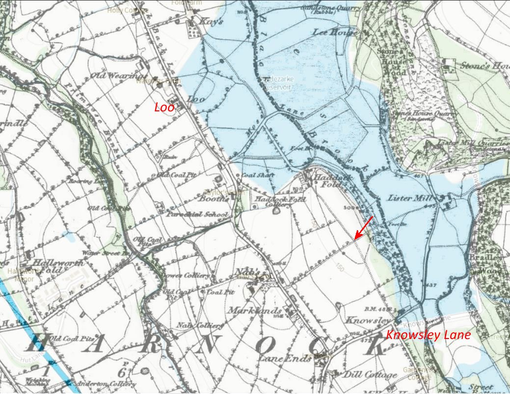 This overlay shows the alignment of tracks and field boundaries in 1849 before the Anglezarke reservoir was built which is thought by Paul (and others) to be the Roman road (from Toddington Lane it would pass to the north of Blackrod along Dark Lane, through Grimeford Village and Anderton Hall, following the eastern edge of the reservoir to The Street farmstead and on to Heapey Fold Lane). We set off following the footpath leading north from the lane. This is not on the alignment being slightly to the east of it, but by the time we reached the remnants of a field boundary (indicated by the arrow) we were on the suspected alignment.
 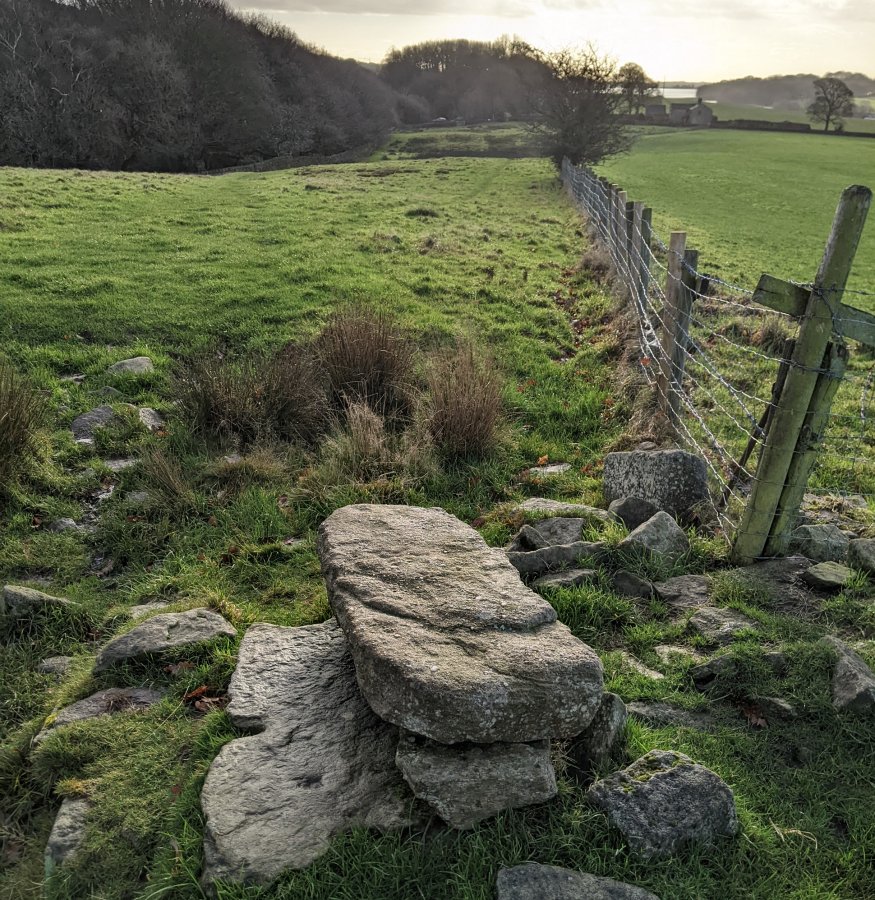 Looking south from there along the fence line, there was nothing specifically to indicate the previous existence of a road. However looking north there was a distinctive bank running across the field.
 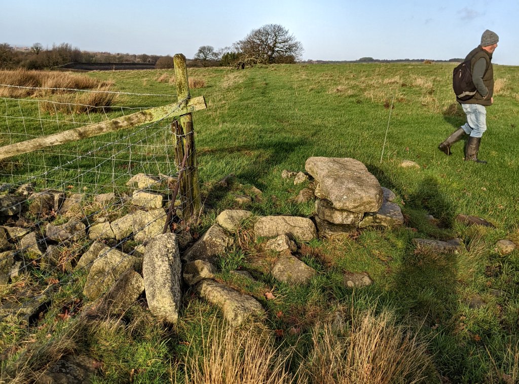 It was noted that, although the remnants of the field boundary was as drystone wall, the stones at this point were significantly larger than those used for the wall. The bank continued further north (difficult to see in the photo) eventually petering amongst the trees as it reached the remains of an old farm (recorded as Haddock Farm on the map).
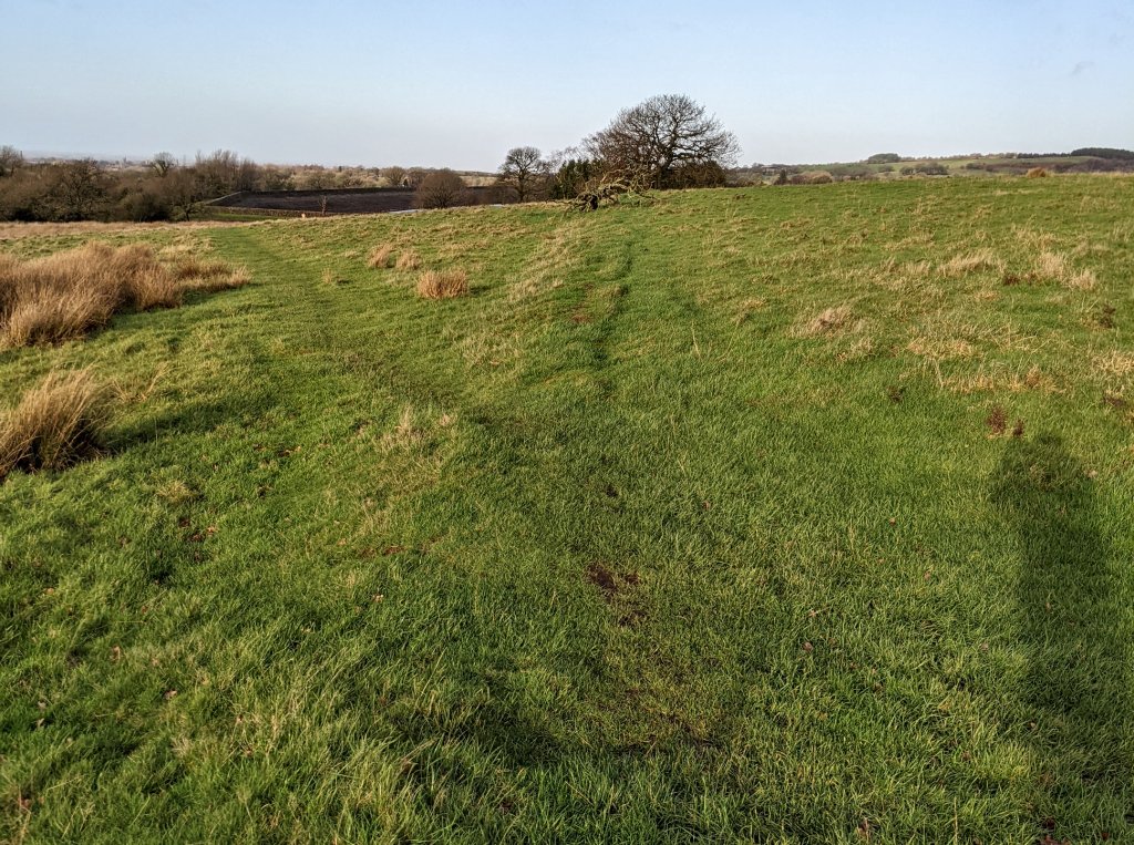
From there we made our way around the reservoir towards Heapey Fold Lane. On the way we past a cottage called Loo which Paul said its name came from the fact that it was built for Waterloo veterans. 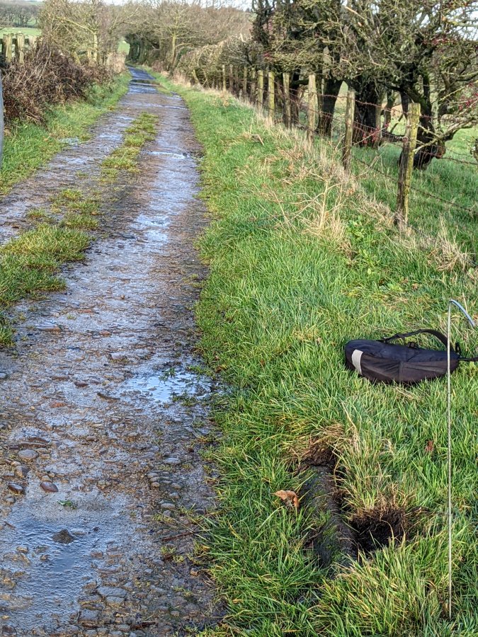 When we arrived at Heapey Fold Lane Paul spent no time locating the kerb which had he had uncovered on a previous visit.
 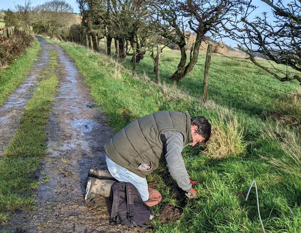 Chris immediately set to, exposing more of it eventually uncovering a several metres of it.
 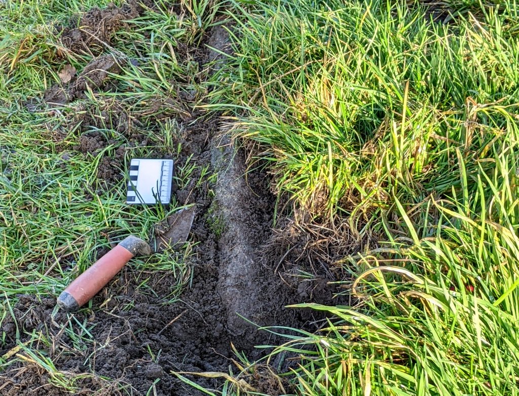 The question still remains as to whether this is evidence for the road – maybe not but at least we now have a starting point for further investigations. Paul’s position gives him unique access to this area which could be a good opportunity for us to carry out work on this important possible route of the road from Wigan to Ribchester.
Date: Wednesday 15th May 2019
Today I persuaded Jack Smith to come with me up Healey Nab to show me where he had excavated with the Chorley Society in the 1960’s. But first Jack insisted on taking me to the site where a hoard of Roman artifacts were found in the 19th century  (coins, two silver necklaces and a couple of what look like broaches but Jack says are earrings). The site is at place called Eagle Tower at Heapey north of Chorley where workmen found the hoard when quarrying stone for the local church (St Barnabus).
  You get a great view of the South Lancs plain from there and Jack is convinced the would have been at least signal station but it’s a fair way of the alignment of the road from Wigan ot Ribchesterand though. Undaunted, Jack thinks there is possible secondary Roman roads leading to Mellor south of Ribchester where a signal station is know to have existed.
Jack isn’t the the best on his pins these days but managed to get him up on the Nab to look for the 60’s excavation site. He was convinced it was not far from the tenon top gate post but, as we found last year, it’s position is up on a slope and Jack knew the site was on the flat. He eventually settle on a position opposite the entrance to the field on the west side. I wasn’t wholly convinced as the B&W photos show hawthorn trees adjacent to it – maybe he was slightly too far north. Anyway managed to get some drone shots looking south.
 On the way back Jack pointed out an area of cobbling which seemed suggestive of the cambered edge of a Roman road (note no curbing though).
 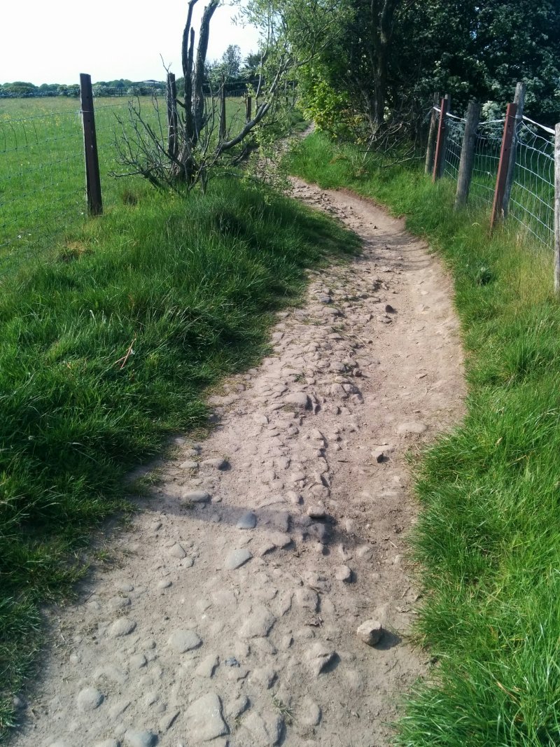 We also got talking to the lady lives in the cottage north of Kays Farm. She said she always assumed the lane was the Roman road and didn’t seem averse to us carry out a survey in the adjacent field.
Date: Sunday 28th January 2018
Three of us to day, despite the wind and rain, myself, Darren and Ashley (plus Debbie the dog) to see if we could find where Chorley Society excavated in the early 1960’s. The Lane passes Healey Nab on the east side and is roughly on an alignment with the Street, a farm which is located on the western edge of the Upper Rivington Reservoir. In the 1960’s George Birtill, who was local historian and former Mayor of Chorley, wrote a book about Rivington and Anglezarke entitled The Enchanted Hills. In it he talks about the Street, saying “the name goes back to Roman times and it is surmised that the Street was part of a road linking Blackrod and another Roman camp“.

6 inch OS Map of 1849 (1st Edition – before the reservoir was built)
With this in mind, in 1962 members of the Chorley Archaeological Society carried out a small excavation on Heapey Fold Lane. Jack Smith, former chairman of the Society took part in the excavations and describes the location as not far north of Kays Farm near a “tenon top” stone gate post. What they found was a cobble surface and kerbing pointing in the general direction of Heapey. Here are photos of their excavations, kindly supplied by Jack. 
 The kerbing was found on the east side of the track so this view must be looking north towards the Nab. In view are Mr & Mrs Tootall and Mr T Crear

 The cobbling shown in photo looks suggestive but the road width could not be determined as only the east side was excavated (although Jack’s proposal was 4 metres). The ‘Tenon Top’ gate post is still there but from these photos it is difficult to located exactly where the dig took place.
 As can be seen from this 1849 overlay, the track has shifted over the years and the Croston’s Heights farmstead had disappeared but presumably the excavation was somewhere in that vicinity.
  This photo is a view of the Nab looking north from Croston’s Heights (note the white marker post – the tell-tail sign of the gas pipeline put in many years ago).
  The next series of photos are views of various locations south of this position which are possible locations for the excavation (although none specifically match Jack’s B&W photos).
Looking north Looking east
 Looking south
Looking north Looking east
 Looking south
 Think we probably need another word with Jack.