
The general assumption in the past has been that, if a direct route from Wigan to Ribchester did exist, the alignment would likely be up Wigan Lane, turning either down Chorley Road or Leyland Mill Lane. The latter is a more direct route, heading through Red Rock and Arley and on towards Adlington Common. However a route on the east side of Wigan through Whelley and Haigh is worth considering as it avoids a difficult double crossing of the River Douglas. The Roman road to Manchester, which crossed the Douglas at the bottom of Millgate, is well accepted and a road to Ribchester could have branched off from this heading northeast towards Haigh. This route could have followed a straight line foot path which is known locally as the Wash Path. This path is more or less in alignment with the Haigh Road which in turn, lines up with Toddington Lane.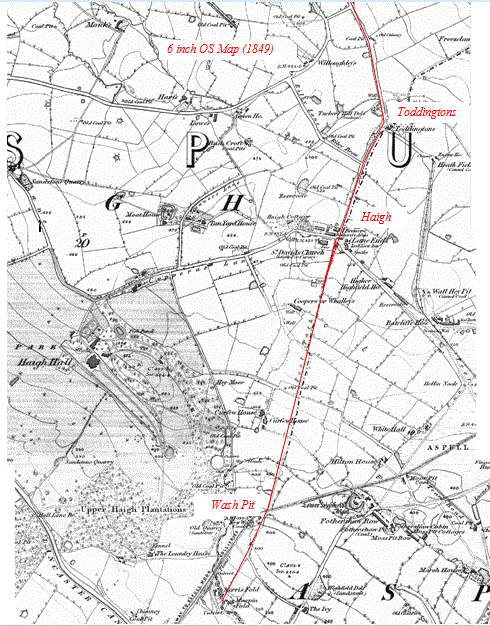 This alignment certainly is old, as attested by the fact that it corresponds with the ancient boundary between the Salford and West Derby Hundreds. It changes direction at Toddingtons farm where the road turns into a farm track. This is a high point where it is assumed there would have been a realignment to return to the original direct route. The farm track was in fact the original main road out towards Blackrod before Riley Lane was built in the early 19th century.
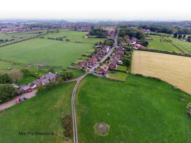 A supposed broken milestone lies on the east side of this section about a third the way down. Mrs Pendlebury, who lives on the farm at Toddingtons, has always suspected this and the road to be Roman.
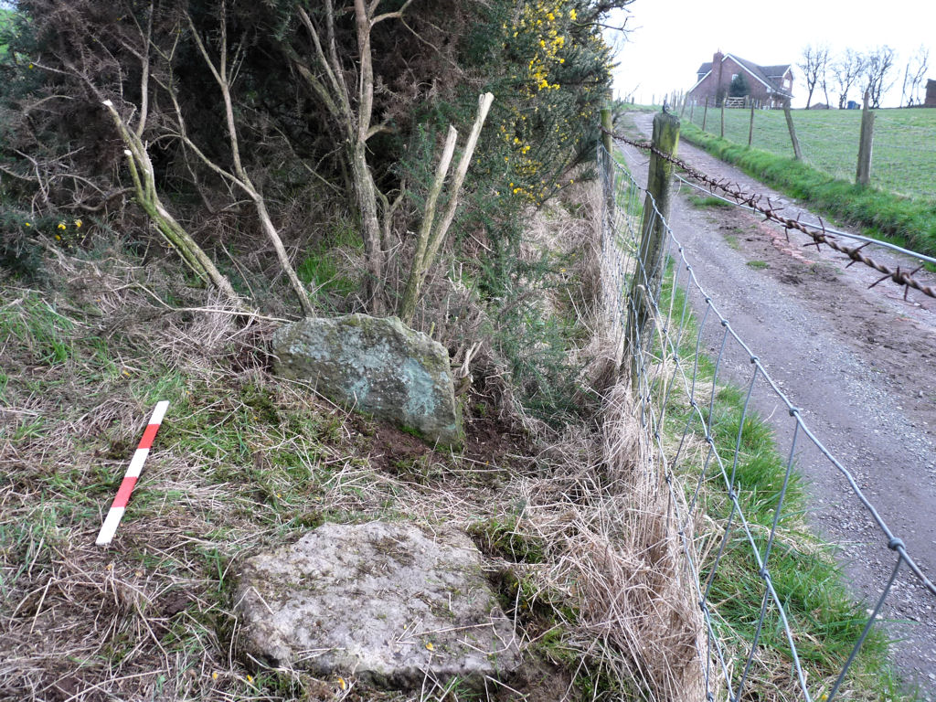 Mrs Pendlebury’s Milestone – In March 2017 we were invited by Mrs P to visit the site and see the damage inflicted on the stone in the 1970’s when it was hit by an excavator travelling down the lane. On inspection, we soon realised that it wasn’t Roman (these tend to be circular in section) and it probably wasn’t even a milestone. It didn’t look Medieval either as these tend to be square in section and mounded in a base. However Mrs P was quite keen for us to investigate further, so we decided we would return at a future date to have a closer look. As it happened we ended up staying there all summer. You can find details of our investigations here.
At the time we also visited the Wash Path which lead down the side of St David’s Church in Haigh. 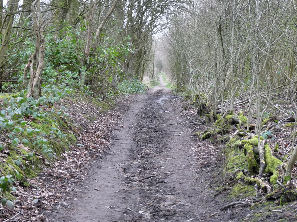 David Ratledge had supplied us with a LiDAR image of the area which showed what appeared to be parallel ditches running along the length of the path. Our visit was to see if we could detect these on the ground.
 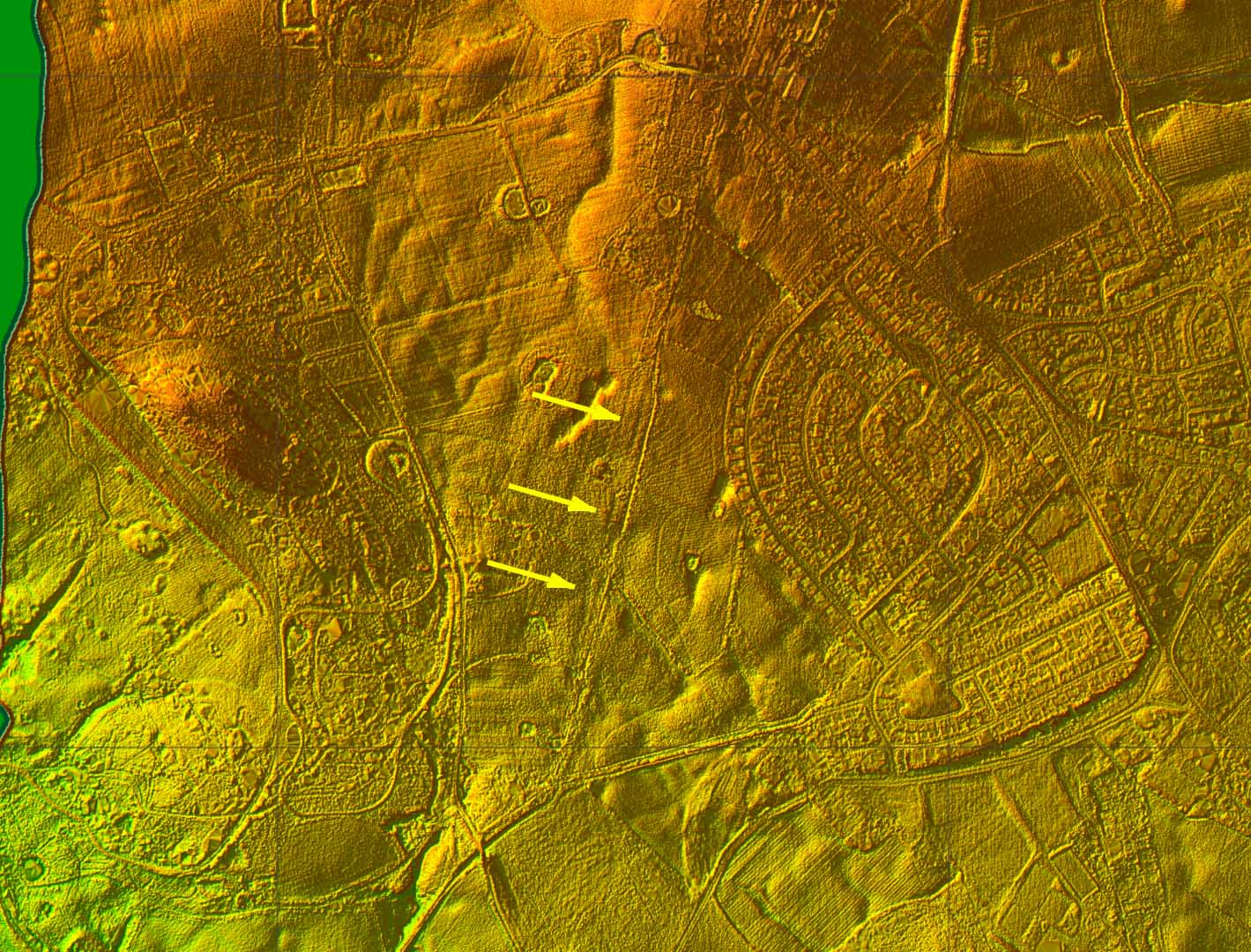 Despite intensive searching we couldn’t find any sign of these ditches, but looking closer at the 1849 map we can see that the current path has moved further to the east.
 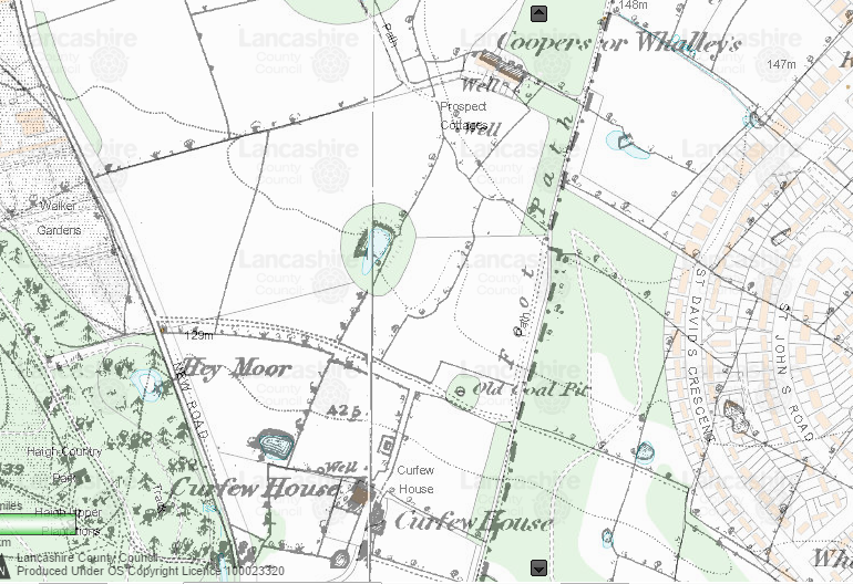 The likelihood is therefore that the easterly ditch on the LiDAR is probably the remnant of the earlier path but still no explanation for the westerly ditch which we couldn’t even detect on the ground. At the end of 2018 we took some photos from our drone but still no sign of the lines shown on the LiDAR (could they be due to marks in the tall grass left by a tracker?).
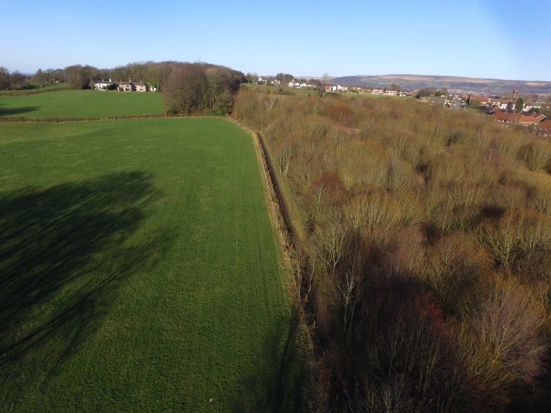 Looking at the south end of the Wash Path where the New Wash Coal Pit was located, we suspect that there has been significant re-landscaping.
 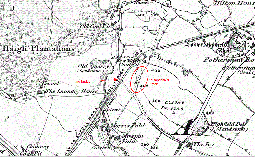 On the 1849 map we see a track projecting from the site of the pit south towards Wigan but this totally disappears on later maps and nothing of it can be seen on the ground. This can be explained by the fact that a bridge was built over the railway line for Higher Lane, which is the road leading into Haigh Hall grounds.
 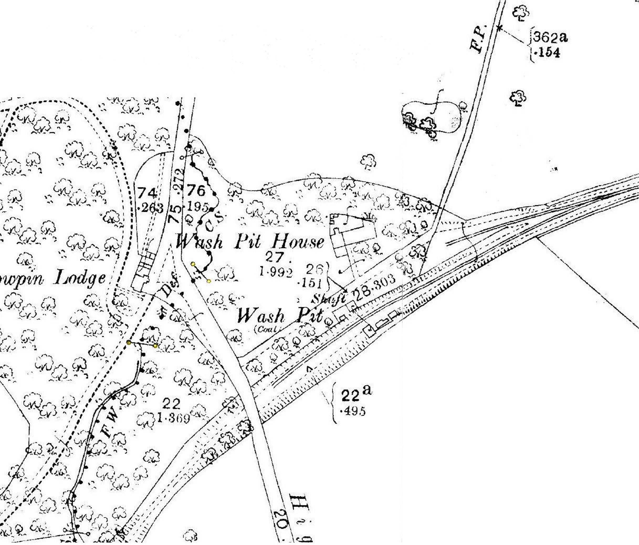 This required an embankment which has obliterated all signs of the track projecting from the pit. Nothing can be detected further south but if it did continue is assumed it would line up with the Whelley Road.
Looking north from Toddington Lane, there is an alignment with the Lane at Little Scotland on the east side of Blackrod. However there is nothing obvious beyond that although the alignment does point towards Babylon Lane in Adlington where another realignment would put it back on to the general alignment towards Ribchester. This would lead it between the hills of Anglezarke and Healey Nab on the west side of Rivington Reservoirs and on through White Coppice towards Ribcheaster. 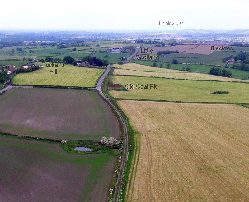 In November 2017 we carried out a geophysics survey on the alignment in a field adjacent to Dark Lane to the west of Blackrod, but failed to find any evidence for the road. You can see details of our investigations here.
In 2019 we returned to Toddington Lane to finish off some loose ends i.e. could we find evidence of the old road on the other side of the farm track and also could we find evidence of the well marked on the 1949 OS map.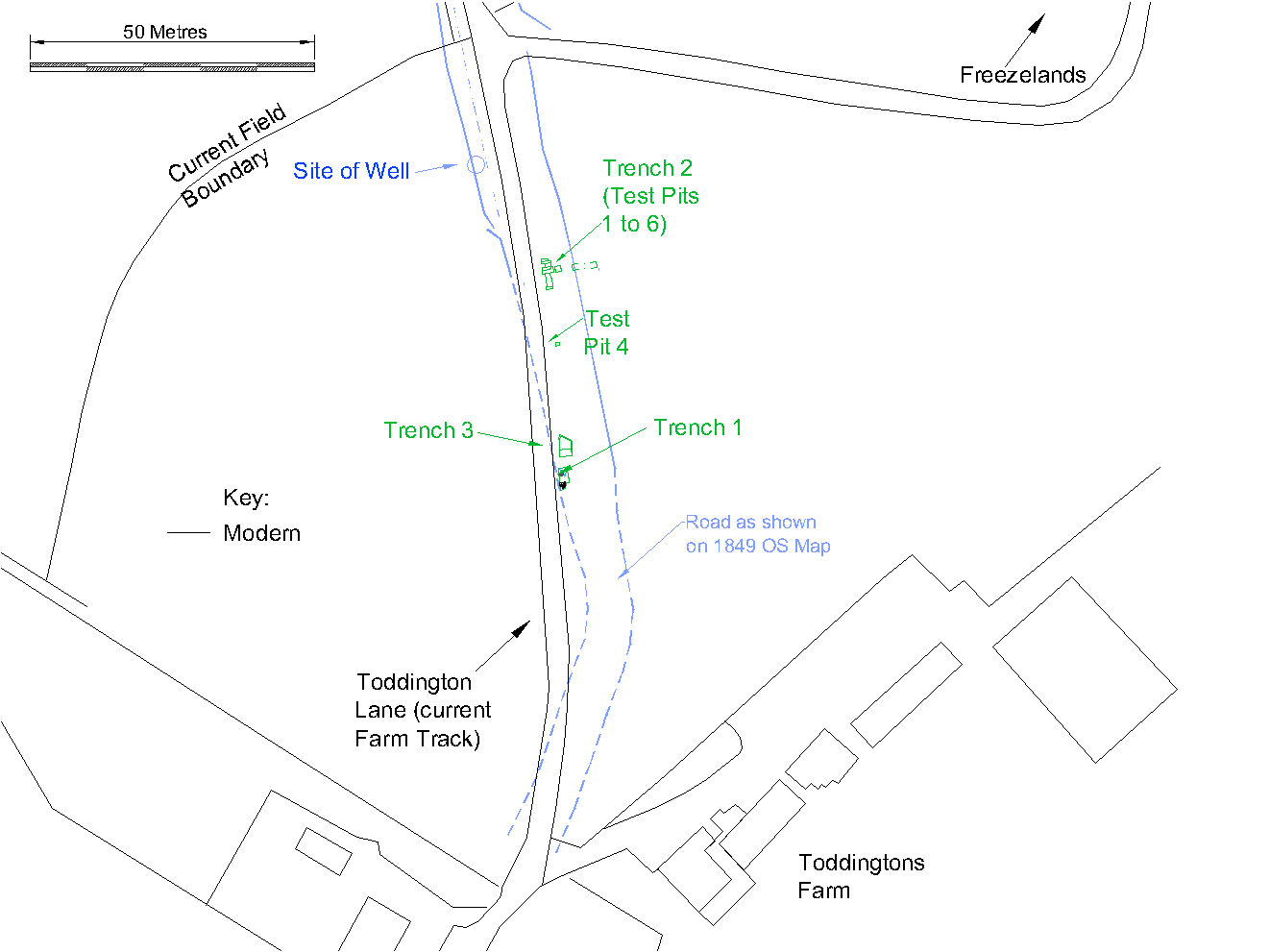
You can see details of our investigations here