
In February 2020 our attention was drawn to crop marks appearing on earlier versions Google Earth in a field in Aspull. They only appear in 2012 and 2013 but as they span over 12 months it suggests they are likely to represented something more than just agricultural activity. What is interesting about the rectilinear shapes of the crop marks is that they have all the hallmarks of a DMV (i.e. a Deserted Medieval Village). A circular feature on the left side of the field could be even be prehistoric. 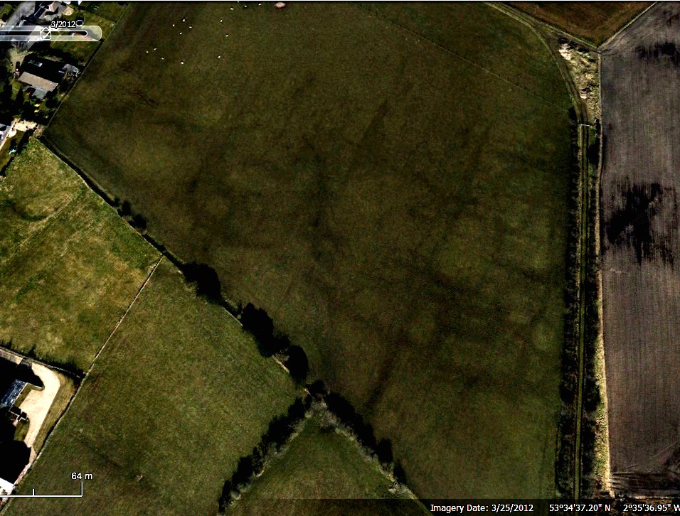 DMV sites can be found all over the country although few occur in the northwest (the nearest examples is perhaps at Tatton Park in Cheshire). Their dates can range across the whole of the early Medieval period although they are usually the result of either the plague or clearance by the lord of the manor to create a park (as was the case at Tatton).
The field lies on the east side of Haigh Road and is bordered on east and north side by and on old railway line which originally led from Wall hey Pit to Heath Field Cannel Pit on the north east corner of the field. 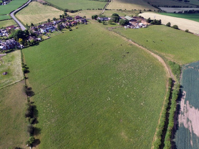 The old maps show an old field boundary cutting across the bottom corner of the field but apart from that, nothing else can be seen (the old boundary is also the only thing to show up on LiDAR).
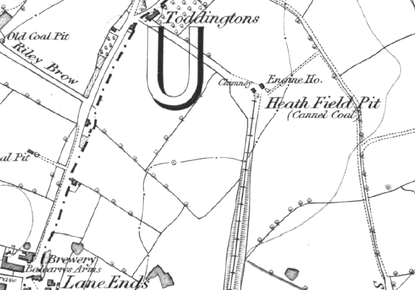 Later aerial images on Google Earth also fail to show anything but a Bing Maps image (not sure from what date) does show the field to have a typical herringbone pattern of field drains.
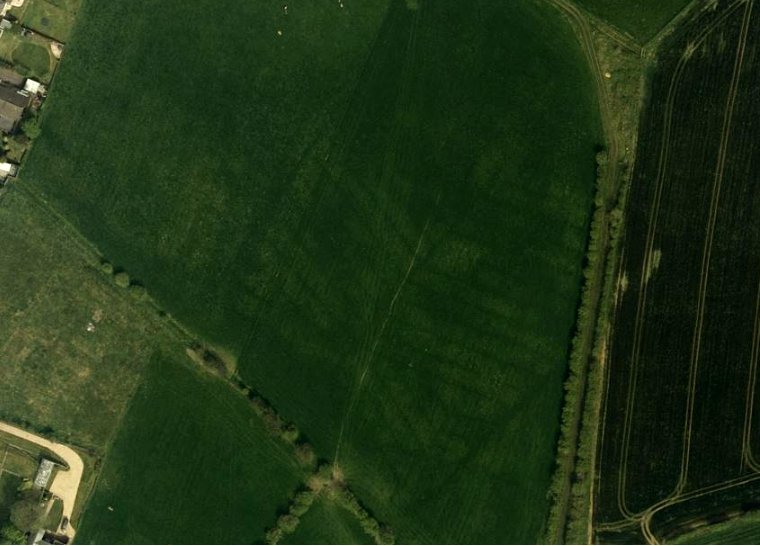 Historically there isn’t a lot recorded about Medieval activity in the Aspull area. However there are a few moated sites within a mile or two radius that date from this period – Moat House Farm lies in the grounds of Haigh Hall just north of Copperas Lane – Gidlow Hall which still has its water-filled moat, lies to the south of Dicconson Lane and finally Lower Highfield (now known as Manor House Farm) lies just opposite Duke’s Row on Wigan Lane. Interestingly though Higher Highfield Farm, which dates to the early 18th century, lies just to the south of the field we are investigating. Also an earlier Higher Highfield House is marked on the 1849 OS map – could this have been another Medieval manor house?
Although not much to show historically in this area from the Medieval Period, the crop marks were interesting enough to warrant further investigation. This we could do with a resistivity survey and as the field was only being used for pasture we were confident a date for this could easily be arranged – but then of course the pandemic struck and it is only now, twelve months later, that we’ve been be able to progress this. Luckily we discovered that the field is owned by the farmer at Toddingtons who quite generously allowed us to excavate recently in his fields to the north of the farm (i.e. Mrs Pendlebury’s Milestone and the Well Site on Toddington Lane). The first thing to do though was to create a drawing from the maps and aerial photos so that an area to investigate could be selected that would hopefully identify significant features.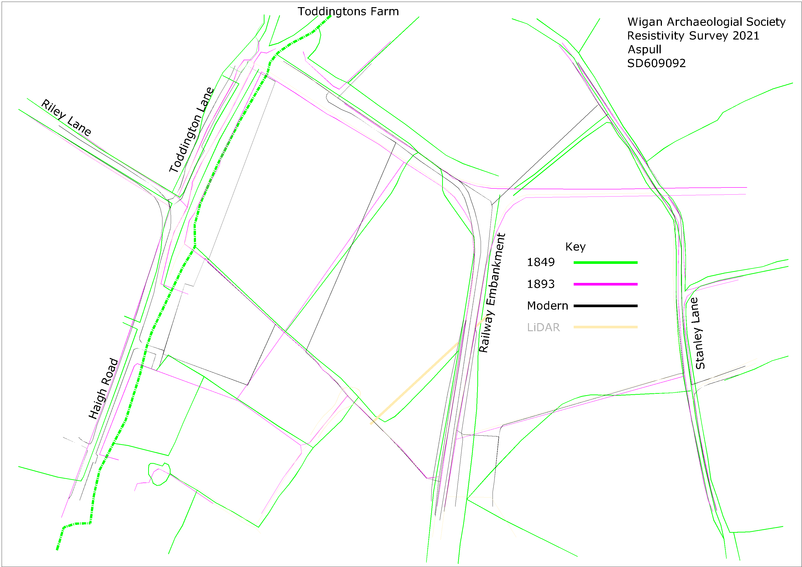
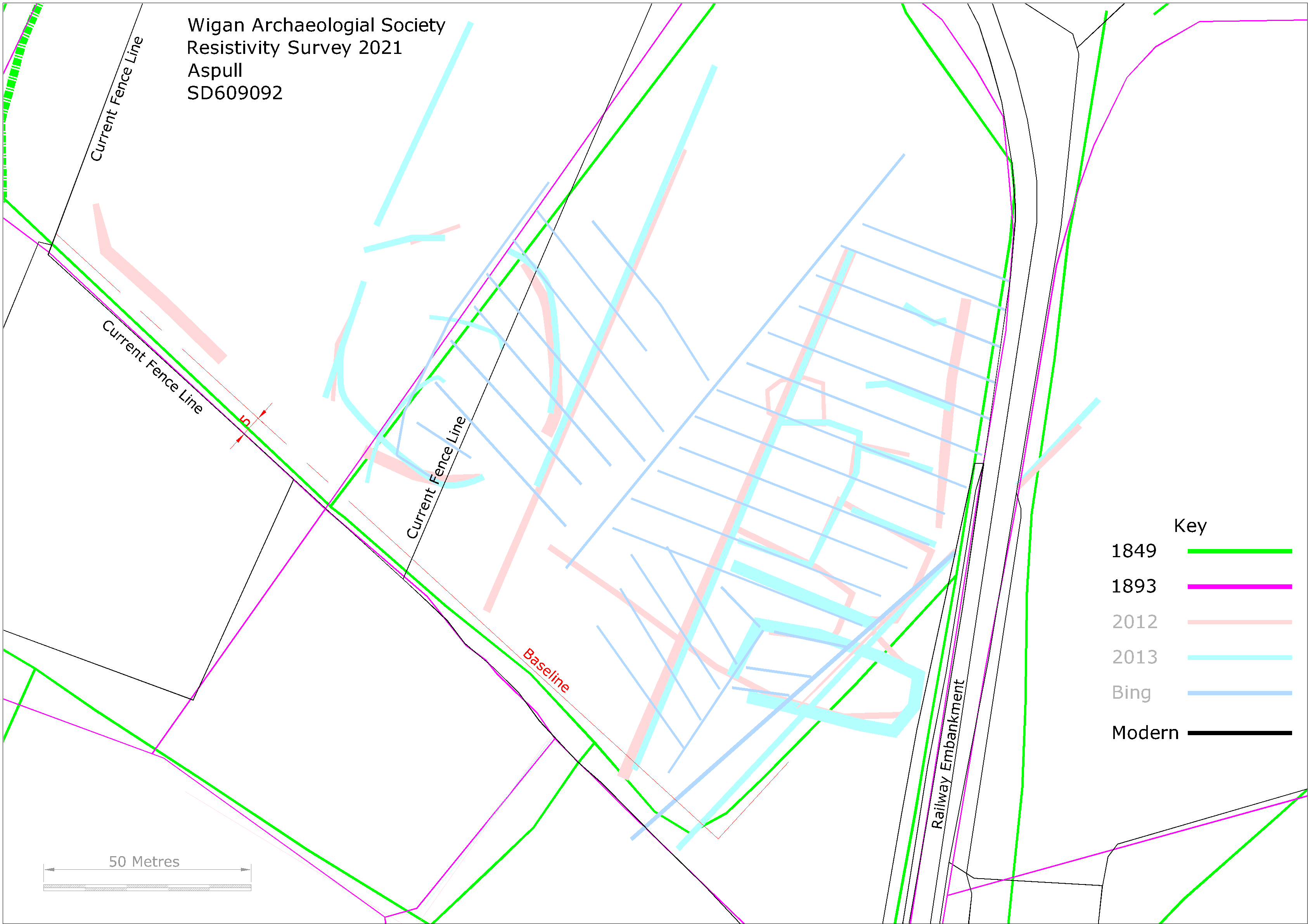 As can been seen from this drawing some of the horizontal linear features seem to line up with the field drains detected on the Bing aerial photo. We located our initial scans however, over areas that would hopefully capture some of the sub-rectangular features not related to the field drains and also one of the strong linear features that runs parallel with the Haigh Road.
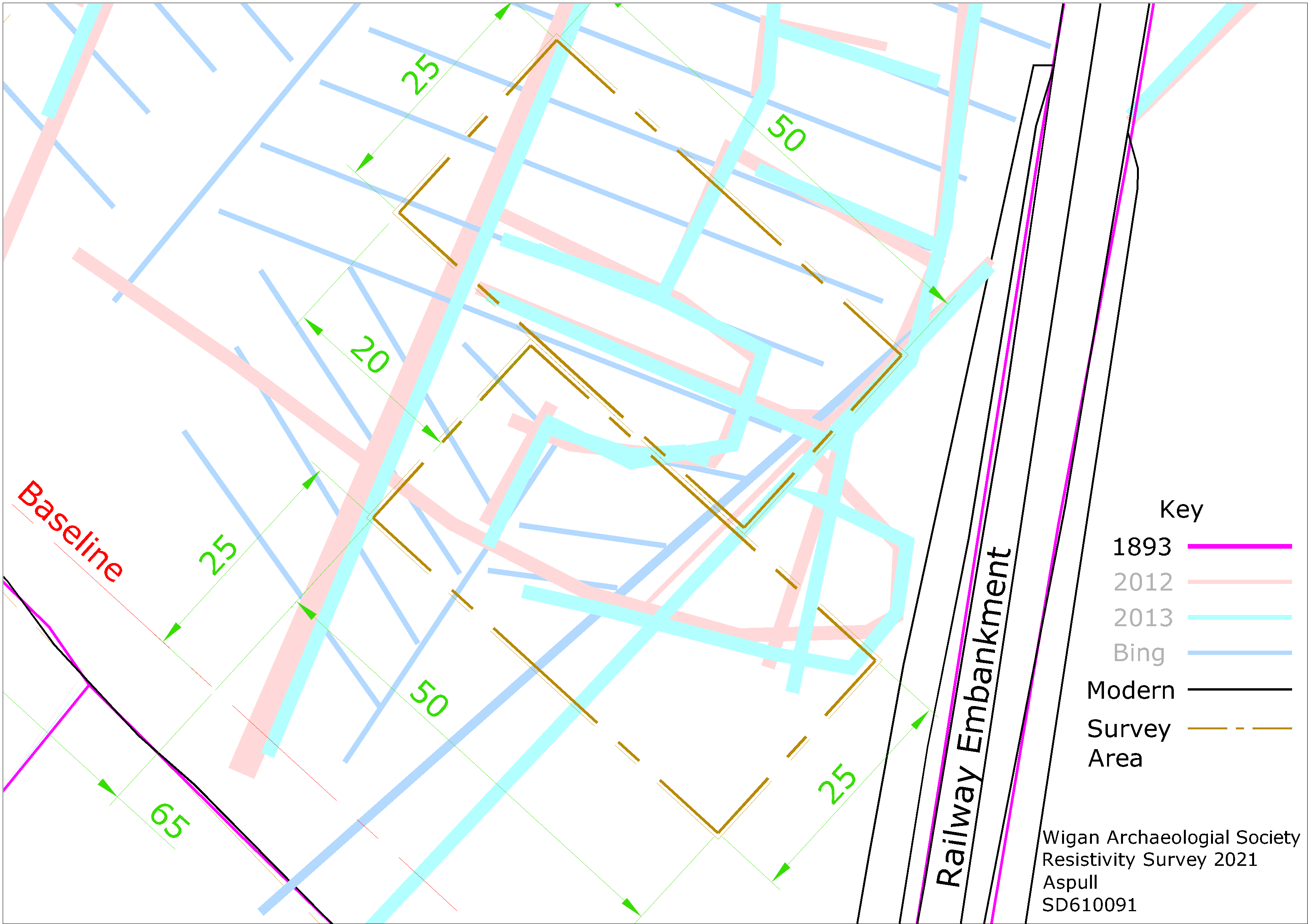
First Survey Day (Friday 7th May 2021)
We picked a good day for the survey, managing to avoid the hail and thunderstorms which seem to be quite prevalent this month. Our small party of volunteers (due to the current Covid restrictions only six allowed) gathered in the morning at Toddingtons for a site briefing before making our way into the field which was only a short distance away (beside myself attendees included Jim Meehan, Chris Drabble, Christine Barbour-Moore, Dave North and John Smalley). Everybody agreed it was great to be out in the field again and were looking forward to see what we could discover. 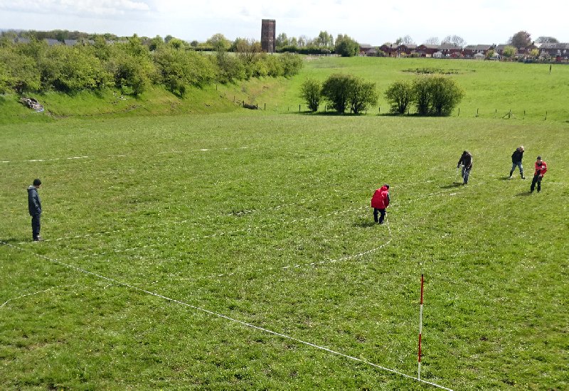 As usual some time was taken setting up of the survey areas. This was made easier, however, by Patrick and I having set base line on a previous visit 5 metres offset from the southern fence line. Our first 25 metre x 50 metre scan area was located 25 metres from this into the field and 65 metres southeast of the current fence line running down the centre of the field. Our second scan area was located another 25 metres further into the field but offset 25 metres to the northwest hopefully to catch one of the strong vertical features running parallel with Haigh Road (mentioned earlier).
By mid-afternoon we had completed our second scan (by this time Patrick had joined us and Christine had left thus maintaining or contingent of six). The results however, when loaded onto the computer, were disappointing. 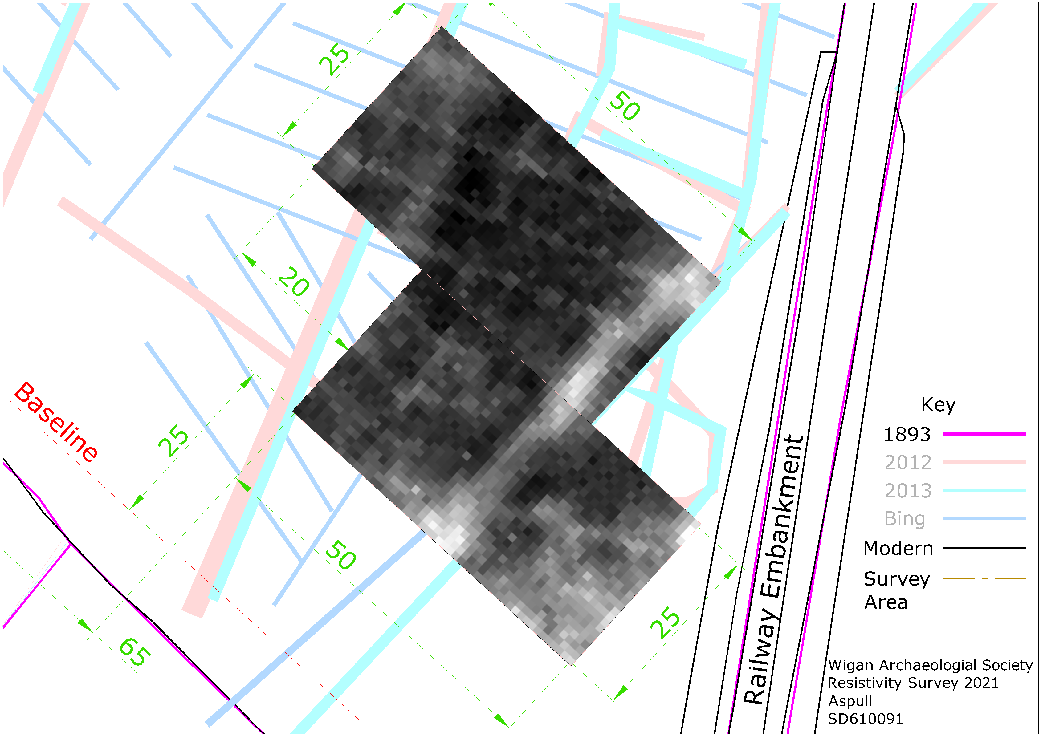 The herringbone pattern of the field drainage system was quite clearly revealed suggesting that, as we suspected, this was the cause of most of the linear features. The only other major feature we detected was the old field boundary although it was showing as high resistance suggesting compacted bank rather than a ditch or perhaps even a stone wall. There are some unexplained features including high resistance at the bottom edge of the scan and with the farmers permission it maybe worthwhile putting in a test pit or two to investigate these. However I think we can forget about the idea that this was once the site of a DMV. We also have the ring feature on the was side of the field which will require another site visit in the near future.
Second Survey Day (Wednesday 26th May 2021)
Anther good turnout albeit with a slightly different crew (this time , I had Andy Wilcock, John Needle and new member Kadie Gray joining me together with Chris Drabble and Patrick). Our target this time was the ring feature in the south west corner of the field. The problem presenting itself though was that it straddled the current fence line. Our strategy therefore was to do two separate scans on either side of the fence line. For ease of marking out we also decided to use the fence line a the base line (although not a permanent feature, it does appear on current maps so scan locations can be easily transferred on our layout drawing).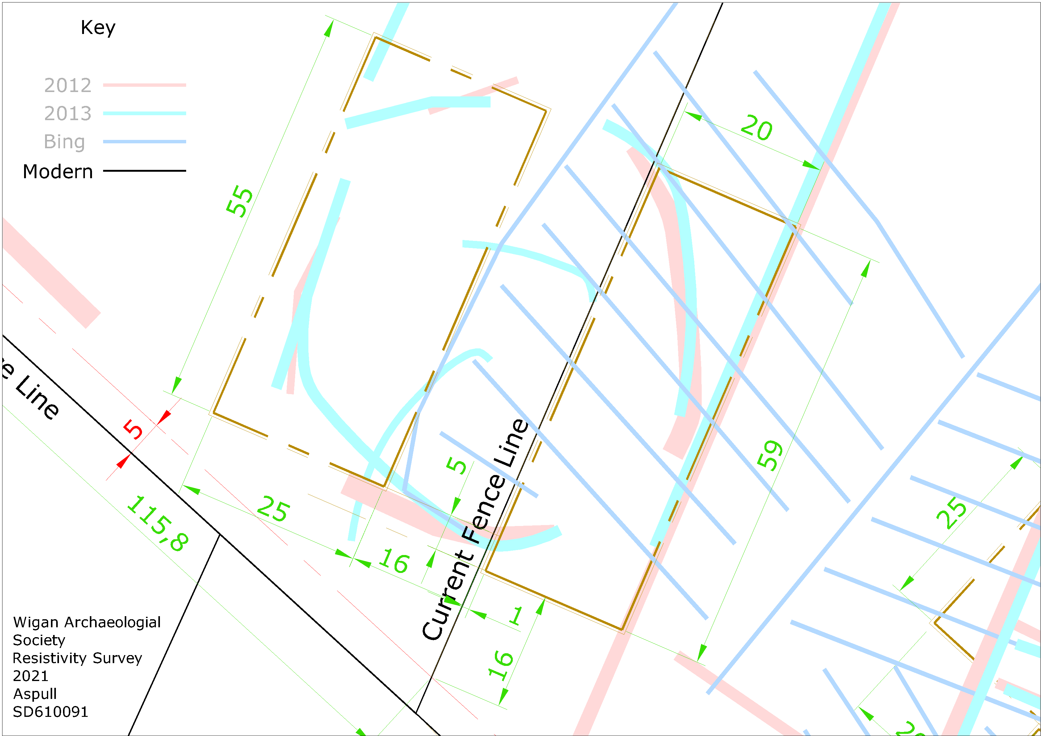
When doing resistivity scans various things can impede your progress – at Burscough it was stalks tangling the wire, at Blackrod it was cow muck. Here it was the mud – horses had churned up the ground and just walking across the field was a task in itself. Resistivity can be quite frustrating, more often than not we fail to detect anything of significance – we keep going though because occasionally we hit the jackpot like the spectacular results at Burscough. Unfortunately that was not the case on this occasion. We did manage to pick up more of the herringbone pattern of the field drain system we had previously discovered but nothing at all of the ring feature showing from the crop marks (maybe the ground was just too wet to detect the ephemeral features we were looking for).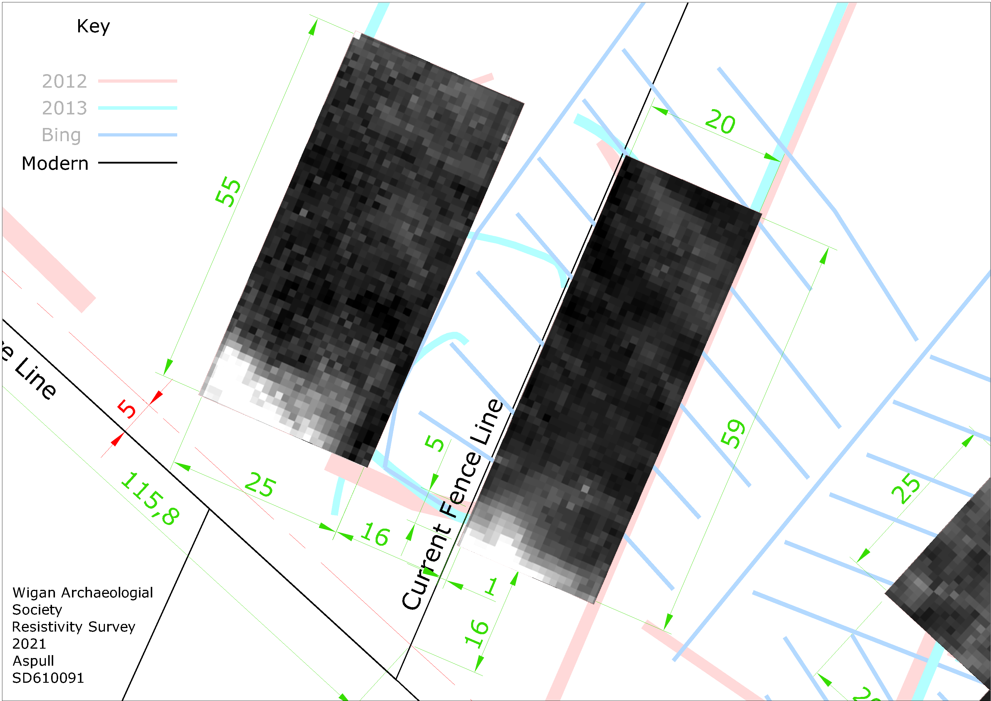
On both scans we’ve managed to pick up a high reading along the bottom edge but they are big – if not a track, most likely will be natural. We didn’t have time for test pitting on the features revealed from our first trip but we did have time for a quick coring exercise which we did across the major high res feature from our first trip. This revealed sandy stone material at a depth of about half a metre. Our enthusiastic team also managed tiny test pit on the same feature but failed to produced any evidence of man-made activity. This seemed to confirm that this prominent high res anomalies is most likely to be natural.
Ah well at least we tried (it maybe worth a test pit or too across the new anomalies but I suspect we’ll get the same result).