
This was the first time the Society had ventured out to do actual fieldwork. Our 1983 interim report had highlighted the two fields in front of Brimelow Farm as having great potential for archaeological survival. At the time the farmer had a crop of hay in the north field and, during previous growing seasons when he was growing cereals, a distinct line could be seen crossing it where the poorer soil had allowed weeds to dominate (not as prominent in the hay however). No berm or raised bank could be detected in either field, but there was an embankment in the south field, particularly prominent at the south end of it. It wasn’t however on the alignment suggested from our research, which seemed to be a few metres further into the field. This bank also coincided with a field boundary shown on early maps and, as such, was dismissed as being just that.

South Field looking south
Our initial work in 1985 consisted of us trying to get photographic evidence of the crop mark. At that times I was on a 3 year archaeological course at Manchester University and was able to borrow their equipment, a 15 metre monopole proving particularly useful in the north field.

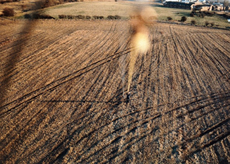
North Field looking north – a crop mark could just about be seen, running from the ranging pole in the centre foreground to the Washery hopper (lining up with the railway embankment beyond, leading up the hill to Standish town centre).
However in the south field, which had been given over to grazing cattle, there was no sign of the road in the low cut grass.
I also managed to borrow the Universities kite which was capable of carrying an remote controlled Olypmus SLR camera complete with motor drive. By then the hay had been cut and any sign of the road had disappeared.
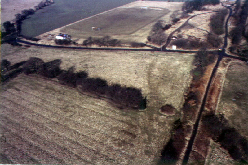
North Field looking South
We did however get some good shots of the further along the alignment to the north following the railway embankment which revealed ridge and furrows in fields on either side. This typically represents a medieval method of ploughing but we suspect not in this case as the ridges are too straight an too far apart. Some have suggested it was a result of a method of ploughing using traction engines at either end of the field with the plough being pulled along via a cable. I’m not too sure though as there doesn’t seem to be much room for the engines on the field edges.
Railway Embankment looking North (Wakefield’s Farm to the left)
The exact same field systems and been detected in aerial photography at Robin Hill in Standish and Trevor Boardman pointed them out to us in Borsdane Wood on our trip there in 2016 (my thought is that they’re more likely to do with field drainage).
Eventually I managed to get hold of a resistivity meter from the University. This was a Martin-Clark meter, one of the earliest machines of this type and as such was very cumbersome and time consuming to use (there seemed to be probes and cables everywhere). We did however manage to complete 4 single line scans in the north field using both Wenner and Double Dipole configurations, both of which showed good results (particularly scans No.1 and No.2). 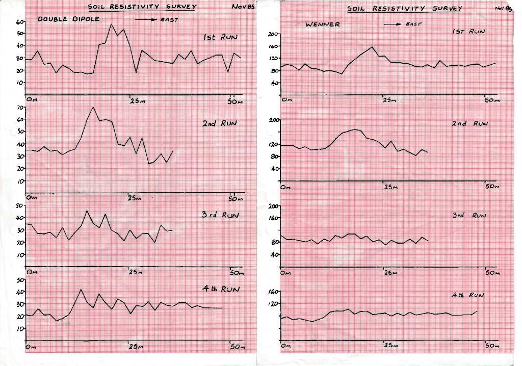 We followed this up on a second visit with another linear scan and an area scan over the most promising previous linear scan i.e. No.1.
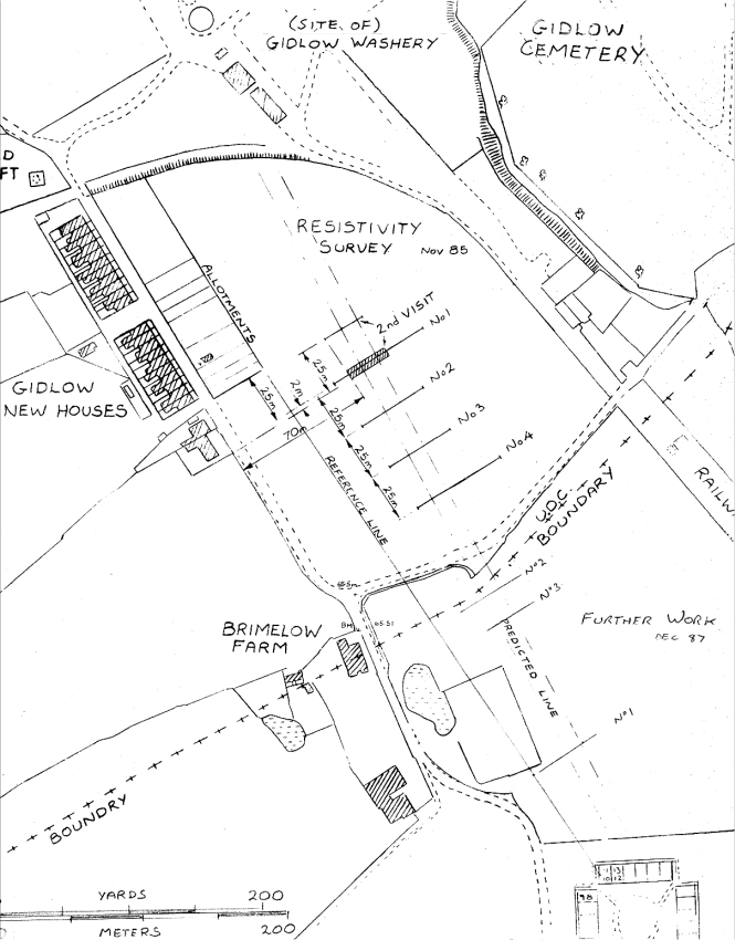 Our 4 x 22 meter area scan produced quite a good result giving us a good target for a future excavation (at that time I was using a free software programme called Vumate which enabled results to be displayed in 3D .

4 x 22 metre resistivity scan looking north east (displayed using Vumate software)
At this point it’s worth pointing out that a result in this field wasn’t wholly unexpected as the 6 inch map of 1849 was showing a track crossing this field on the Roman road alignment. However it didn’t continue north or south and therefore didn’t make any sense unless it was a leftover from a previous arrangement (it disappeared sometime in the later 19th century as it isn’t shown on any later maps). If it was a remnant of the Roman road then it must have continued across into the south field. In 1987, therefore, we carried 3 more small area scans in the south but were disappointing revealing nothing to indicate a road. However we had a target in the north field and and that was going to be we were going to carry out our very first excavation (you can see the details here – Brimelow 1988).
Frustratingly and annoyingly for us though, we had been beaten to it by the Greater Manchester Archaeological Unit who, at the end of 1986, had opened up a trench on the northern edge edge of the north field. It was instigated by Stuart Nichols, director of the Unit at that time. He had been to seem me earlier in year to ask me about the research we had been carrying out and promising to involve us in any work they planned to do there. This never happened and the first we heard about the dig was in the local newspaper (Wigan Observer Jan 2 1987). The work was actually carried out by volunteers recruited by the Manpower Services Commission and in the paper Nichols claims to have “identified a number of anomalies that indicate a substantial cobbled area with a drainage ditch on one side”. However bad weather hampered their work and the resulting report was quite brief with Nichols admitting the road was not definitively identified – although “a localised stony deposit may represent the road metalling very much disturbed by agricultural activity”.
(back)