
We first became aware of this feature when Steven Twigg (formally of STAG – South Trafford Archaeology Group) contacted us with an aerial image in 2019. The crop mark shows up quite clearly as a dark green circle and seems to represent a circular ditch around 40m in diameter. Viewing various other aerial images spanning a number of years confirmed the mark to be more than just a temporary agricultural feature.
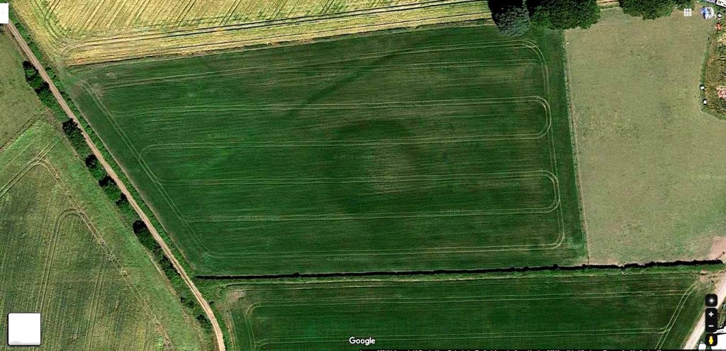 The size of the circle would suggest something prehistoric and probably older than Iron Age as it is certainly bigger than a roundhouse. The LiDAR image however revealed the site to have a shallow mound in the centre. This would suggest a Bronze Age barrow (similar sized ones can be seen at Normanton Down in Wiltshire). Its central mound and continuous surrounding ditch would suggest a Type 2 Bowl Barrow as classified by Historic England. (ref)
In the Autumn of 2021, we carried out a resistivity survey of the site with very encouraging results as reported in our October Newsletter (No.246). This year we’ve been able to return to carry out further investigations and start a season of excavations. You can find more details of our Aspull Ring Ditch project here
– and follow our the progress with our Site Diary blog here
Aspull Ring Feature
Reply