
Another great trip on the West Pennine Moors led by the team at Horwich Heritage Centre. As in previous years it was headed by Derek Cartwright with help from Gary Rhodes and this time with Ste Hamer and Phil Luff, former Rivington Ranger. As on the first trip, we met at Jepson’s Gate where Derek gave a quick overview of what he as about to show us. 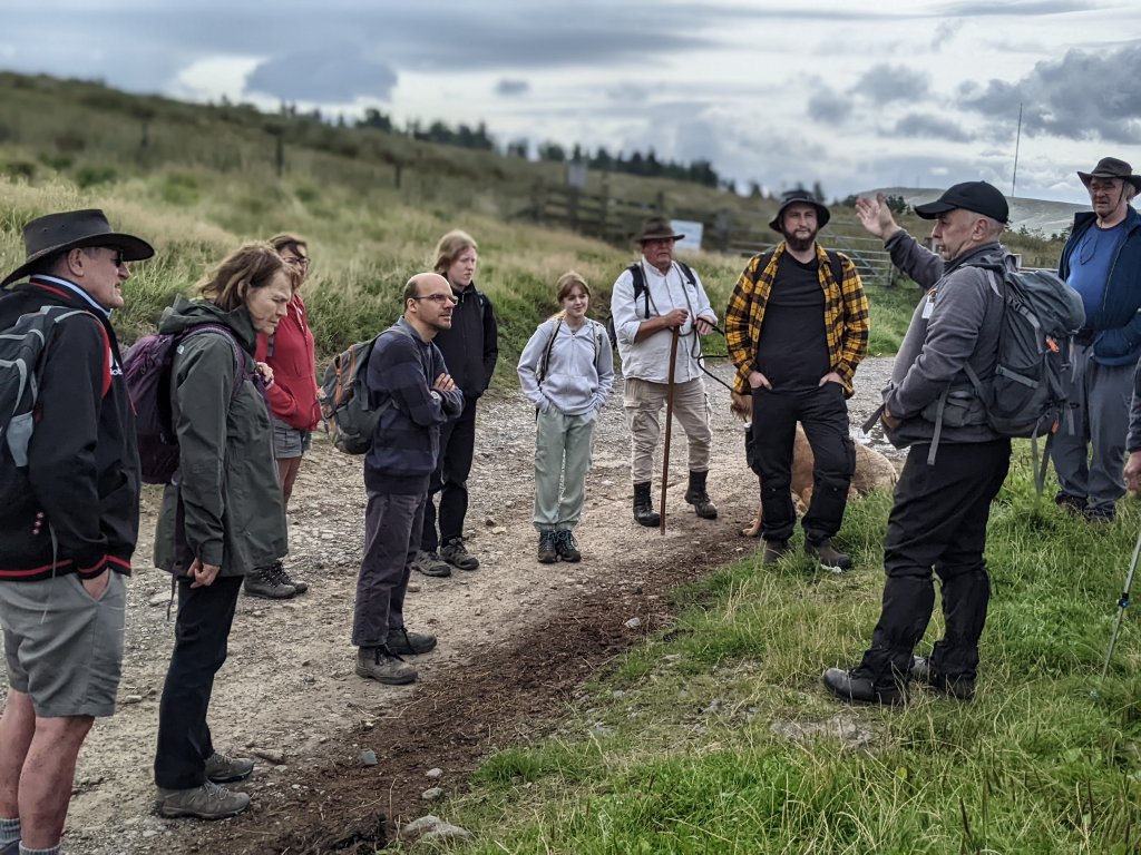
He then led the way across the moor to our first site, i.e. Pike Stones. This monument is referred to in its scheduling (No.1009120) as being a chambered long cairn dating from the early to mid Neolothic (i.e. 3400 – 2400 BC). All that is left though is a group of large gritstone slabs leaning against one another. Originally it would have been covered by a large mound perhaps 48m long and up to 19m wide. 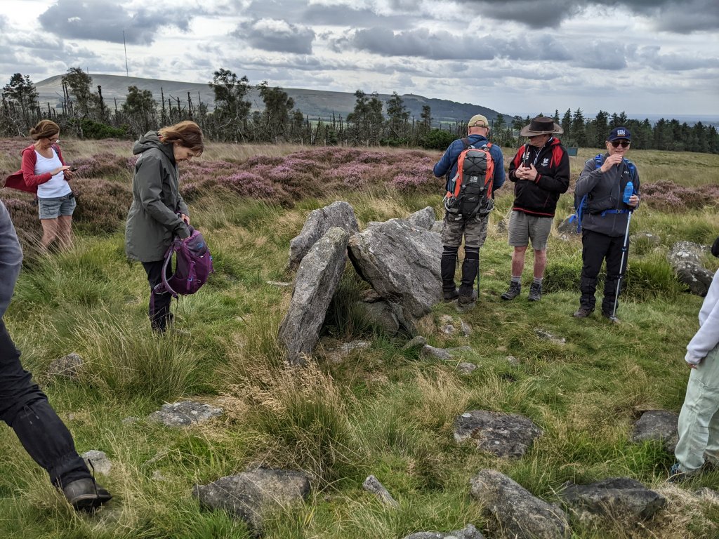 Bu’lock, who first reported on the site in the 50’s, recorded it as having a horned (or ‘vestibuled’) entrance making similar to the early Neolithic long barrows (known as Cotswold-Severn types) found in the south of England. Frances Lynch however, studying it in the 60’s, suggested perhaps it belongs to the group of Derbyshire megalithic tombs (such as the ones at Minninglow in the Peak District).
Derek then took us to a small round overgrown cairn about 400m away to the northwest siting in the lee of the ridge called Rushy Brow on the south side of Hurst Hill (Rush Brow was found to be a Mesolithic site and was excavated in 1985 by a team from Lancaster University). On top of the of the cairn we saw a ring of stones which Derek said could be recently placed, but there were lower stone seemingly well embedded in the structure and therefore not recently placed. 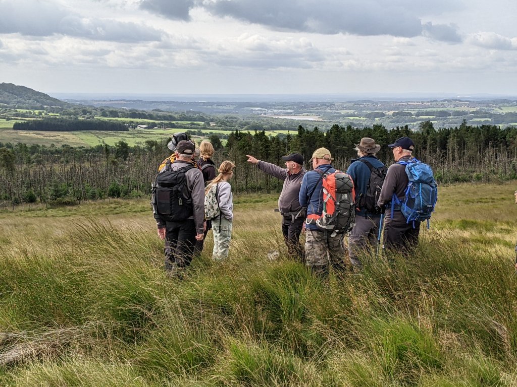 Derek also mentioned that there were said to be another ring of stones further out lying under the vegetation and therefore not now visible.
Continuing our journey eastwards, Derek pointed out a huge log discovered in a drainage ditch when it was being dug. Probing the surrounding peat had revealed it to be quite large and branching, therefore likely to be a felled tree. As it lay below the peat, the suggestion was that it was ancient. 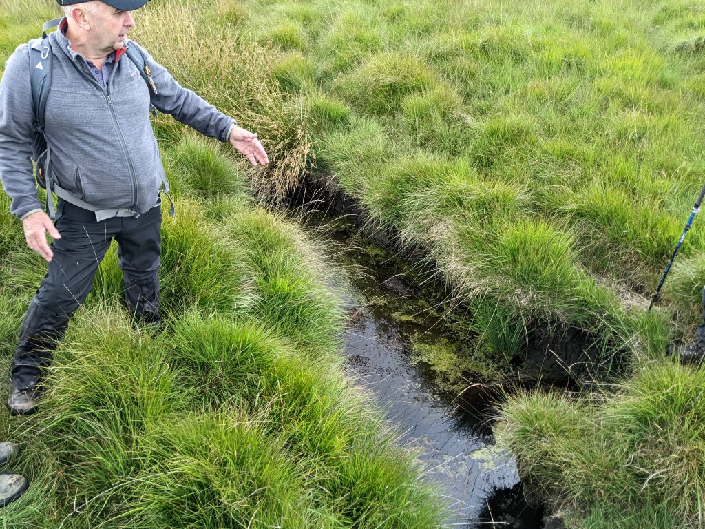 According the 1996 report by C. Howard-Davis, peat formation started on these moors in the late Bronze Age (1200 BC) and the area was previous heavily wooded before the clearance during the early Bronze Age. If this log could be proved to be ancient, it would be a remarkable discovery having survived in the anaerobic conditions below the peat for so long.
Derek then took us into the upper reaches of Lead Mine Clough where it turns into the Limestone Clough. In the 18th century this was the site of James Yate’s Well, a locally famous ‘spar’ where people came to ‘take the waters’. It seems to have been calcium rich as objects said to have been left in the stream ended up with a calcified coating. There was no sign of the well now, just ochre stained water seeping out of the valley side. 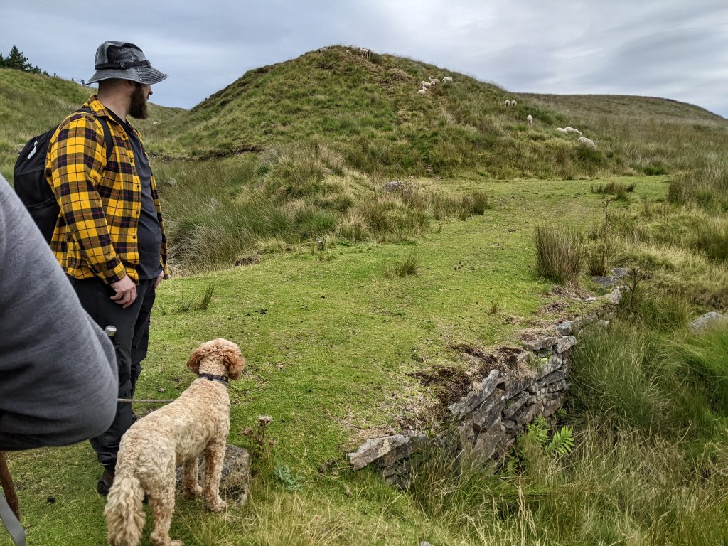 Gary commented that the calcium rich water was very peculiar as geologically there was no limestone in the area. He could only imagine that there was perhaps a small seam of it associated with coal measures in the area.
From there we made our way towards the unmistakable tumulus of Road Loaf rising unnaturally in the middle of the open moor. 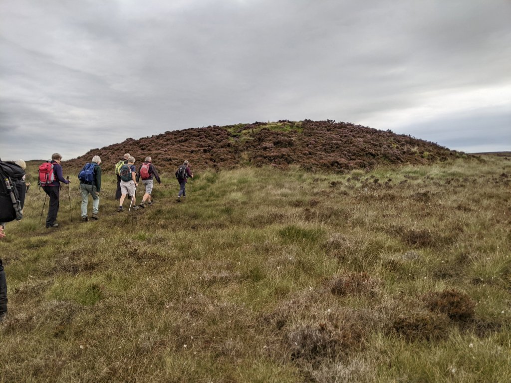 As we approached it, we realised we were being followed by a large group of walkers so Derek stopped us before reaching it to let the walkers stream pass and to tell us something about the mound. Measuring 57m by 49m, it rises to a height of almost 6m. Probing around the base Derek said they had detected the mound continuing beneath the peat to a depth of over a metre all around, making it several metres bigger in girth (significantly though no sign of an outer ditch). Its scheduling (No.1008904) describes it as a bowl barrow but Bronze Age barrows are not normally this big.
 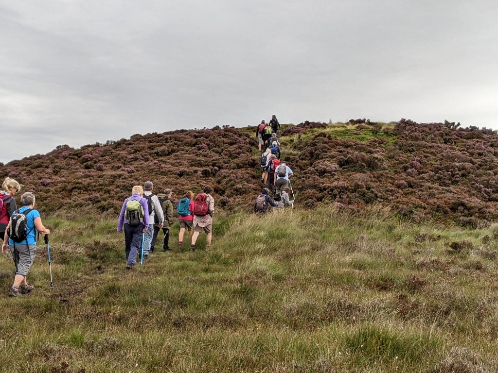 Also its pear shape form had suggested to some that it’s more likely to be a natural glacial deposit. The site hasn’t been officially excavated but Derek mention that local archaeologist John Hallam, came across some local enthusiast in the 70’s, digging a hole in the top of it. The cavity was apparently big enough to allow him to be lowered down into it, and his distinct impression was that the construction was artificial.
Before climbing the mound ourselves, a man with his dog mention there was a lady looking for us. In the dim distance we could see a lone figure making their way steadfastly across the moor towards us. With the white baseball cap and distinctive swagger, it could only be one person, Alison, one of our site volunteers. Having rode all the way from Blackrod, she’d left her bike locked up at Jepson’s Gate and – realising she’d missed us, she’d made her way directly to Road Loaf. After apologising for being late, she explained how she nearly didn’t make the day having falling in a ditch and hurting her knee the day before (we were all just amazed she’d been able to find us at all).
Leaving Round Loaf, Derek guided us northwards towards the Black Brook which leads down towards White Coppice. He took us to a crook in the stream where there was a small plateau, an idea spot sheltered from the wind where we could have our lunch. Whilst having our rest we speculated on the reason for some shoes nailed high up it the surrounding trees (maybe they were acting as nesting boxes).
Setting off again down the valley towards White Coppice, Gary was keen to show us the location of several bell pits where lead ore was mine in the 18th century. Further down Derek took us to the entrance of a shaft going into the valley side. It had been partially block up but had recently been opened to gain access. This wasn’t recommended but Derek mentioned that people who had been inside, had said the narrow passage opened up inside. 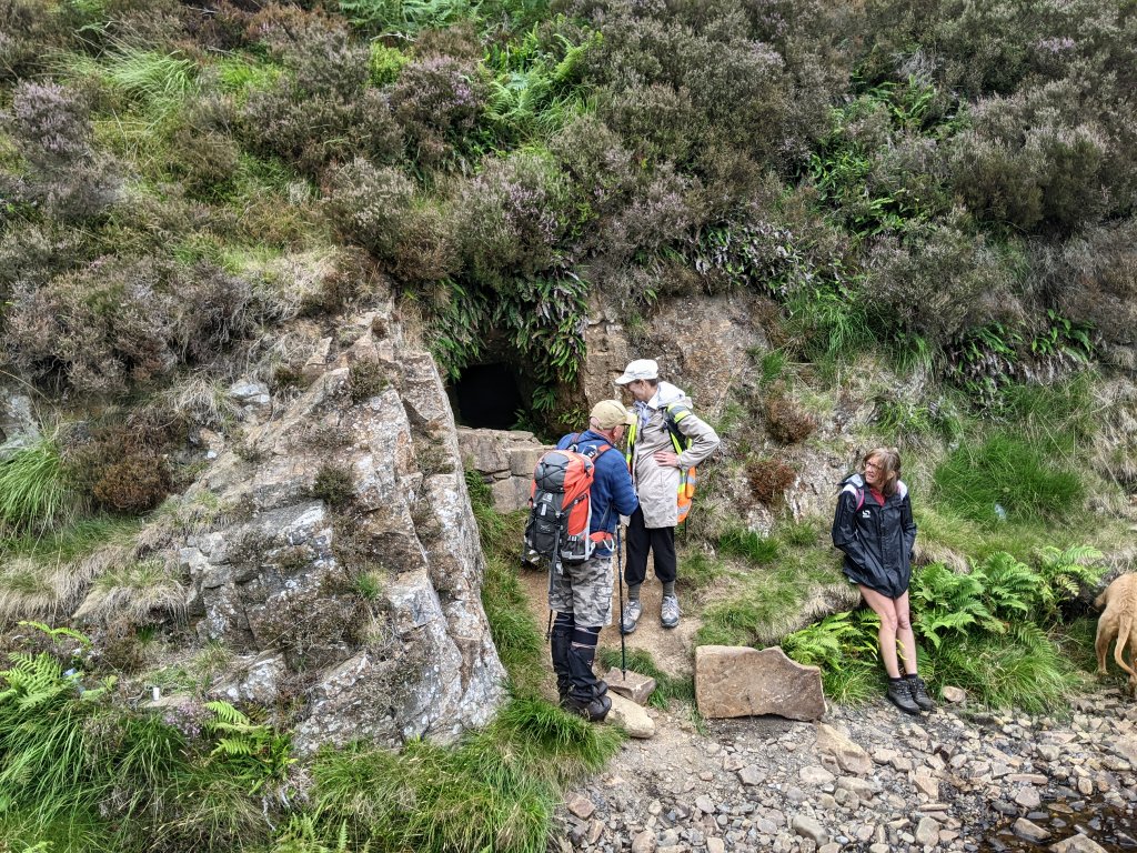
As we approached the head of the valley, we crossed over the stream and climbed up onto the escarpment of Black Coppice. At this point we were greeted by a flyover from the Red Arrows as they made their way over to the Blackpool Air Show. From our vantage point overlooking the White coppice village Derek pointed out another mine entrance at the base of the quarry on the opposite side of the valley (this time with the blocking stones still intact – leaving a small gap at the top for bats). 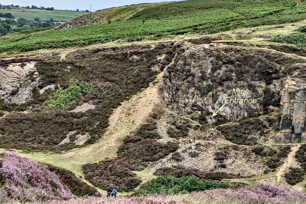
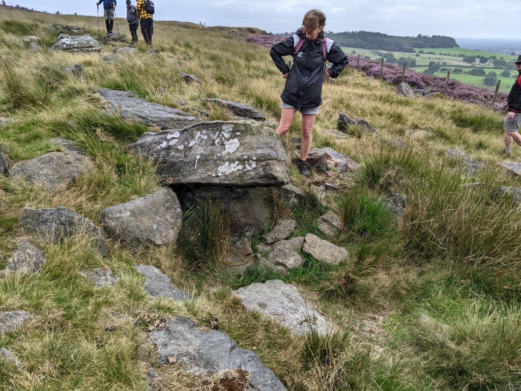
Moving along the ridge we came across our next ancient monument, the reputed Black Coppice Chambered Cairn. First identified by the team from Lancaster University in their 1990’s survey, it comprises of a very large gritstone capstone resting on supporting stones to create a tomb-like cavity below (I must admit I was a little underwhelmed). 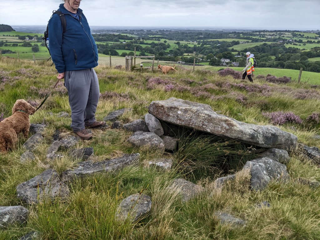 A little further along are the remains of the gritstone quarry where large stones slabs were worked into much valued millstones.
 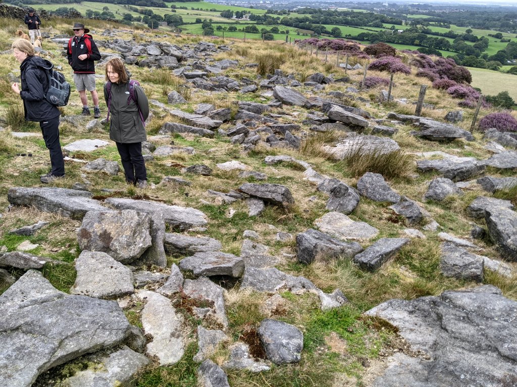 Quite a few of the partially worked and abandoned stones lay all around.
 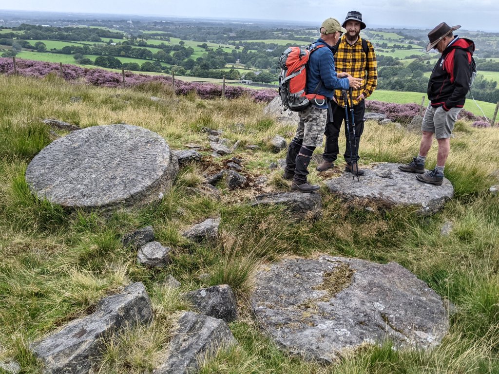 In amongst the field of stones, we began to notice arrangements similar to the chambered cairn we’d just visited. The question was why these had not been also classified the same way.
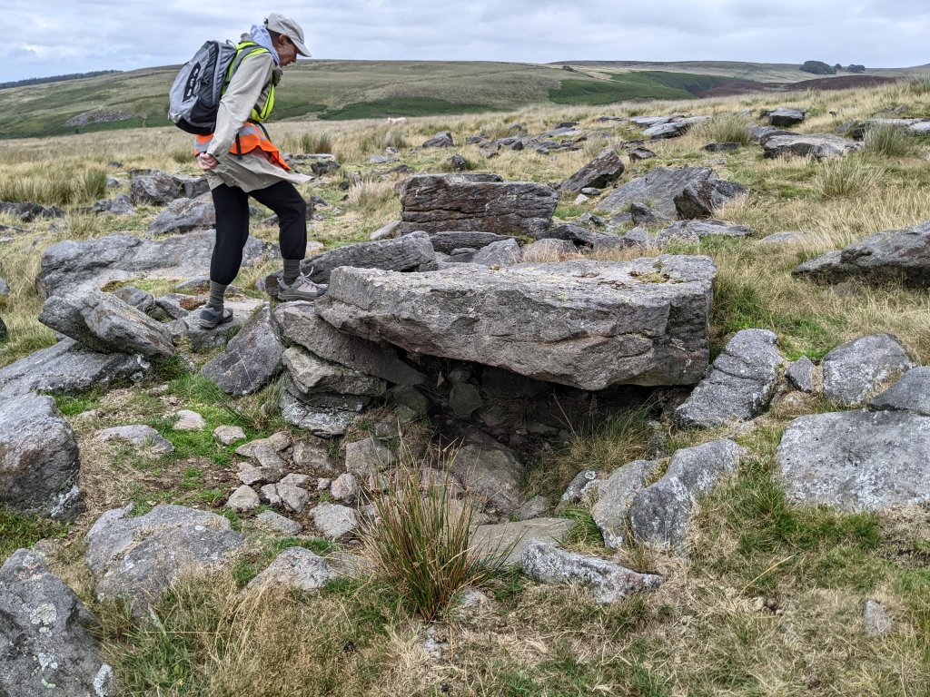
 One in particular arrangement piqued Gary’s interest as the internal cavity seemed to be going quite deep.
 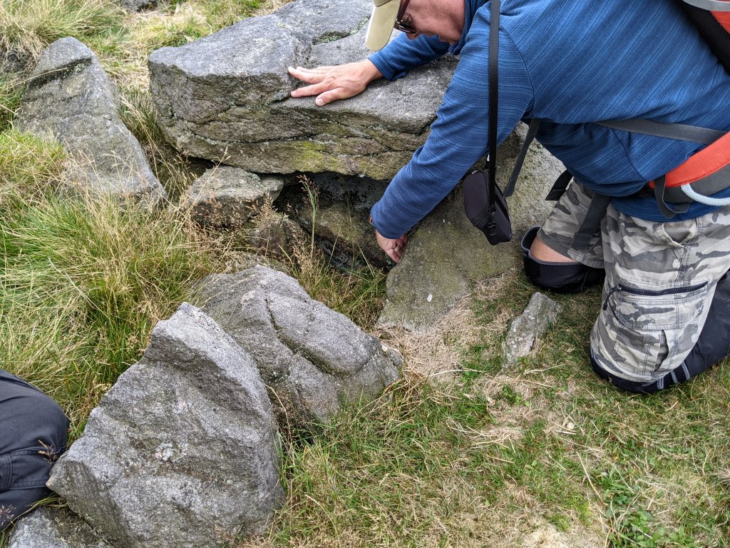 After removing some of the loose soil and stones, a distinctive wall-like structure could be seen below, surely manmade (but if it ancient or something more to do with the quarrying, was difficult to tell).
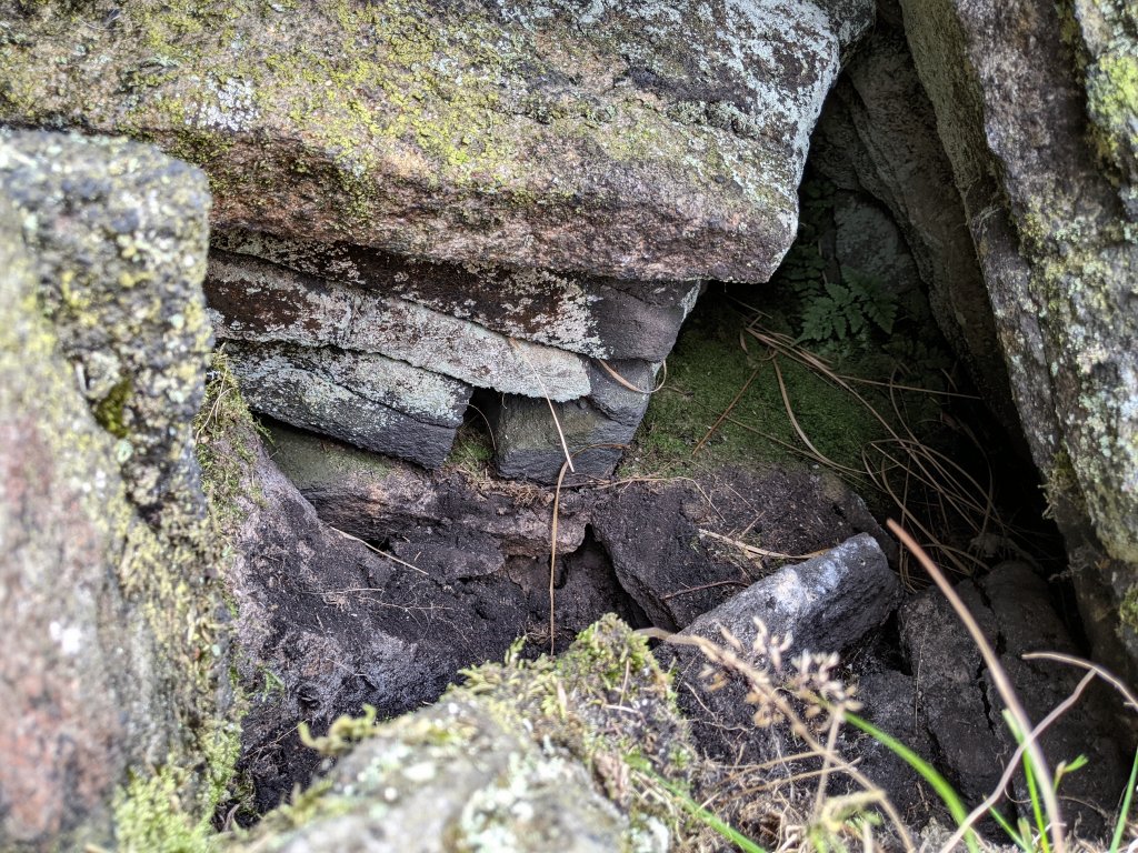
From there we made our way south along the Stronstrey Bank, eventually dropping down onto the road leading back to Jepson’s Gate. As mentioned this was another great trip courtesy of the Derek and his team, for which we were all very much appreciative. Derek said he and Gary would return to the newly discovered wall feature with an endoscope camera to see if they could learn more from it (will report on their findings later).