
Date: June 2004
At long last the south field at Brimelow Farm became available for excavation. This is the field where, in the summer of 2002, we conducted a resistivity survey in search of the Roman road from Wigan to Walton-le-Dale (see Newsletters 54 and 55). Last year the farmer, Roy Brandon, had been growing turf here, but now having cleared it, had allowed us access for some limited investigations. Our 2002 survey did not give particularly good results but there were some indications for us to follow. The farmer, having already re-seeded, was keen to proceed quickly and even helped us with the loan of his small mechanical excavator.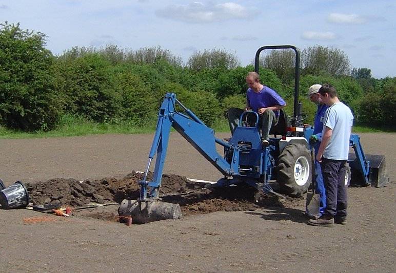 The first trench was put in near our previous excavations in 1989 where possible features had been recorded. The result, however, was disappointing with only a small scattering of small stone cobbling. The depth of sub-soil here is quite thin and we suspect constant ploughing over the years may have destroyed anything in this area. We decided to move our investigations to a strong anomaly in the northwest corner of our surveyed area (dark on our survey means high resistivity). This area also coincides with the point where the Standish Wigan boundary changes direction as it crosses the field a few metres in from the hedgerow (could this be the remains of a marker such as a stone cross?).
 Once again the result was disappointing – there was nothing in the trench, not even the usual smattering of stones. The sub-soil, which is a hard clay, lies on top of the natural softer sandy clay. At this point the sub-soil was certainly thicker and this may be the explanation for the survey anomaly.
The farmer then spoke of stone cobbles constantly coming up in this field when ploughing. As he was growing turf these days he had been using has a special machine for removing them (in fact the resultant huge pile of cobbles in the farm yard was probably our Roman road). He mentioned, however, that at the other end of the field there were less stones and he suggested that, if the Road is there, it might be buried at a lower depth and therefore suffered less damage. We decided to switch our search to this area. We therefore marked out an area for another resistivity survey. Once again, however, results were not convincing – but dark areas, representing high resistance, at least gave us encouraging signs where to start. Using the machine again, our first cut in the middle of the largest dark area, produced nothing. However, as we extended westward, to our relief the cobbles started to appear. We continued with this trench on the following day and, by the time we had reached the other side of the surveyed area, we had uncovered a roughly 9 metre wide strip of cobbling.
 Its appearance was similar to the section uncovered in the north field in our excavations in 1988 and, having checked the alignment with this section and field boundaries appearing on the 1849 6” OS map, the alignment appears quite striking. It is therefore quite convincing that we have uncovered the remains of the Roman Road.
 There are some indications of a shallow ditch on the west side revealed as a strange shaped cut in the natural.
  However, as with the excavations in the north field, a similar ditch on the east side could not be detected. An extended section through this side revealed a layer of grey silt laying over the natural (maybe created by wash coming of the road).
 As with the western edge there was no sign of the underlying original surface but a line of stone was intriguing (suggesting maybe a road edge markers for the construction team).
Further investigations had to be curtailed as the Roy the farmer was keen to get his field back to growing turf – so once we back-filled and cleaned up the site, a bucket of grass seed was on hand for reseeding.