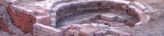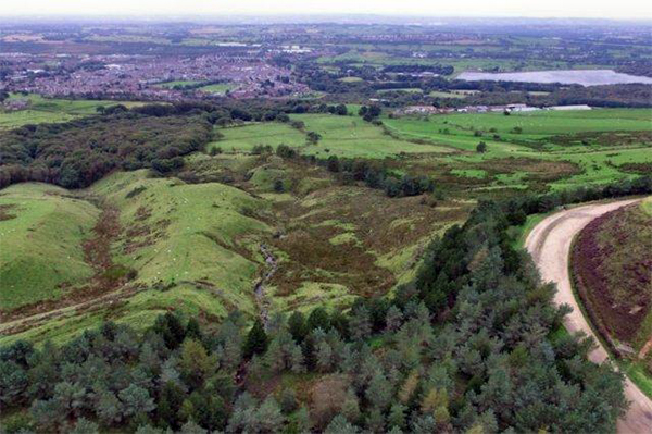
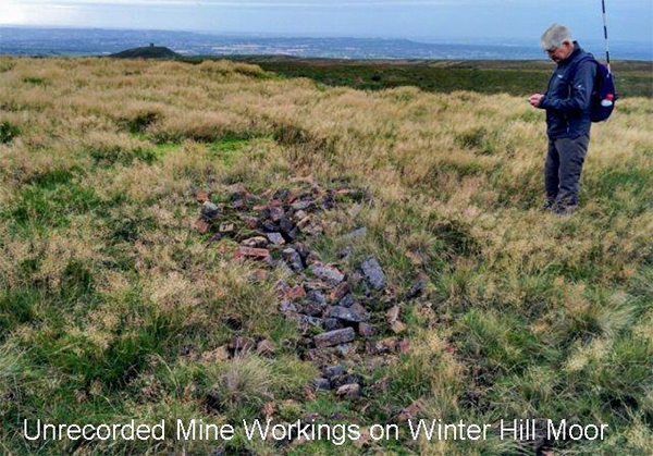
As part of our Douglas River Project, last month Eric and I met at Rivington Barn for a trip onto Rivington moor. This was to see if we could trace the route of the river on the moor and perhaps find its source. I had brought the drone and was determined to use it, despite the gusting wind and not the best light conditions. We got our first encounter with the Douglas on Belmont Road, above the Japanese Gardens, at a place called Brown Hill. Little more than a stream at this point, the river, passes under the road through a concrete culvert. From the drone the river can be seen winding its way down the hillside towards Horwich. In the distance is the Lower Reservoir which the river passes in front of, before passing under Bolton Road on its way towards Anderton. As we carried on along the Belmont Road we passed the marker stone for the boundary between Lancashire and Greater Manchester. A little further on is Sportsman's Cottage behind which is the path giving us access onto the moor. This leads us to our first archaeological site, a curious hill called Two Lads, sporting not two but three cairns. Many myths are associated with these cairns and there have been some periods of rebuilding but I don't think anybody really has any idea of their origin. From Two Lads we made our way up towards the Winter Hill TV mast, which was quite easy once we located the road (single track, although the white line in the middle tries to pretend it isn't). Once there, wandering around the back of the TV station, we came across a concrete culvert carrying a track over what we perceived to be the early vestiges of the river. Just a few metres further up, Eric pointed out what he'd deduced to be the actual source, i.e. a spring (or at least one of them, we assumed it to be the highest). With a feeling of achievement, we took photos and made our way back down the hill. This proved not to be so easy in the boggy conditions with us both at one point or another ending up on our backsides. We did eventually find the track we were looking for but not before stumbling on some intriguing features i.e. mounds of earth and the remains of stone and brick buildings. This was clear evidence of mining activity (the 1849 OS map does show coal mining on the moor but only on the east side - this activity was evidently far more widespread). Our final encounter with the river was from a footbridge which crossed it on the track leading round the north side of the Pike - this was our direction home. It had been quite a successful day and Eric and I, despite the mud, had thoroughly enjoyed it. The intention is to return again perhaps in better conditions to get better drone shots and also visit the sites we missed (i.e. Winter Hill Cairn and Noon Hill). You can see full details of our trip here.
Fort News
Last year we carried out a resistivity survey in the west field at Burscough (see Newsletter No.227 ). Following on from this work, an opportunity arose last month to do another scan once the crop had been taken. We were disappointed with last year's results as the patterns produced bore no relationship to the fort and the anticipated west road was not detected. We put this down to the extreme wet conditions experienced during that summer, making the readings vey low with little variation between the extremes. The linear features that were revealed, were dismissed as spurious, as we had had similar experiences on other sites (such as Brimelow) where the patterns produced were not reflected in the later revealed archaeology. Steve Baldwin however, was not so sceptical and to our surprise, our work this year proved him right. Our similar sized scan (25m x 65m) was targeted, as best we could, over our previous scan but partially overlying it. This would give us comparative data and also extend our coverage. The results not only confirmed the validity of our previous scan, but also we could now detect the west road. Linear features we had previously dismissed still seem to pass over it at an odd angle, but this may well indicate later activity. This is great news and, as it is outside the scheduled area, we will be allowed to follow up with further investigations next year.
Crowdfunded Archaeology
DigVentures are self-funding professionals who have been very active in recent years (even through this year's virus). They have had particular success on a Roman site in East Yorkshire and digging out the moat at Pontefract Castle. It's great that they post their activities on line and you can find out about their latest results here .
Keep safe - BA
|