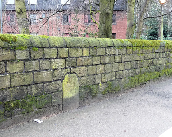
A supposed Roman Milestone, embedded in the wall of the Elms on Wigan Lane, is to be recognised with a plaque. It is thought to be the one that was found during street widening in 1930, being described as over 5ft high, cylindrical but pared down to square sides. Although it had no inscription, A.J. Hawkes, the chief librarian at Wigan, was convinced it was Roman (but later conceded that it may have been Medieval). It is by no means certain though that the stone in the wall is the same one. Apparently the original was thought lost having been broken up and destroyed. It should also be noted that Wigan Lane is not on the recognised route of the Roman road north out of Wigan. This goes behind Gidlow Cemetery, past Brimelow Farm and on towards Preston (as confirmed by our excavations last year and in 2003). However we have also been investigating the likelihood of a directed route from Wigan to Ribchester (this is exactly 20 Roman miles, as mentioned in the 3rd Century AD Antonine Itinerary). Specific evidence for this route has yet to be found; however it may well have started on Wigan Lane, before branching off down Leyland Mill Lane and on through Arley towards Adlington. Already the stone has listed monument status (Grade II) and on our advice, the plaque will just say 'Presumed Roman Milestone - found near by, one mile from the town centre on the possible Roman road from Wigan to Ribchester'.
Fort in the Wood
After the excavations in July we've revisited the Burscough site to carry out more resistivity surveys but this year has proved to be less productive. On our first outing we selected the site where Steve Baldwin had reported seeing evidence of a brick building when a field drain was put in last year. Nothing came up on the survey and, when a scan of the area around the south road of the fort, also produced nothing, we started to wonder if this year's conditions (i.e. very wet weather) had scuppered any chance of getting a good result. We therefore decided to scan the area in front of the eastern fort road which we knew had given a strong signal. This did produce a good result and we were able to extend this road by about 30m. The scan also showed a possible area of roadside building activity. However when we rescanned an area around the southeast corner of the fort, the scan showed a much fainter result proving that the wet weather was having a very significant detrimental effect. We reflected therefore that maybe it was best to wait for a dry spell before continuing. However an opportunity arose to look at the field to the west of the fort where no work had previously been undertaken. We aimed the scan specifically to look for the west road but the result failed to detect it but could this again be the result of the weather conditions. Steve Baldwin has since been in the same field with a GPR machine and indications of a road have shown up. Other features were also revealed in the surveys but whether these are fort related, only future investigations will tell.
Toddington Lane
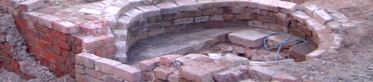
We are now back filling this site having gained as much as we can, although the mystery of how the well worked is still unresolved. Certainly the wet weather had enabled us to see how it was filled, with water streaming through its inlet culvert on the SE side and percolating through the walls of our trench. However it wasn't at all clear how the overflowing water reached the field drain on the north side, as no obvious channel existed from the exit hole on that side of the well. Our efforts to understand the road section also met with some difficulty as we constantly had to pump the trench dry. We did however discover a lower road surface which we are confident, correspond to the one discovered in our 2017 excavations. Without any finds, this lower road is impossible to date but it must be older that the late 18th century road we've identified lying above it. The natural ground surface which rises at an angle from this lower surface, suggests this was in fact originally a hollow way and therefore probably Medieval (not Roman - Mrs P will be disappointed). One last throw of the dice saw us investigating a small mound just to the north of our trench. It is early days but there seems no apparent reason for the mound. A level scattering of small stone below the plough soil, is all that has been found so far. As usual you can follow our progress here.
Next Meeting
Wednesday 4th September - at our new venue The Bellingham (7.30pm as usual). This month we have Neil Coldrick from the Holcombe Moor Heritage Group. He will be telling us about their excavations on MOD sites on the moors near Ramsbottom. These include a Medieval iron smelting site and an early 19th century cotton mill. We visited these sites in the summer and found them to be absolutely fascinating (see Newsletter No.225) and Neil is a very entertaining speaker - hope to see you there, BA.
|