A few weeks ago a group of us collected outside the shops at Bryn Cross, to undertake a field walk along the line of the supposed Roman road running from Warrington to Wigan. The route is well known in this area as it is shown on all OS maps crossing the land between Bryn Road and Landgate Lane (known locally as Sparrow Fields). Excavations on the other side of Bryn Road in the 1990's by the GMAU, also identified the road on this alignment.
It's over two years now since the property developers, Greenbank, were given outline planning permission to build 465 homes, a supermarket and by-pass on the 24 acre site. Since then serious objections from local residents, spearheaded by BAD (Bryn Against Development), have been raised and it appears the whole scheme is stuck in a period of consultation, while detail planning is in progress. From our point of view, the concern is that the application, which was subject to conditions, is taking into account the potential for unrecorded heritage assets on the site; in other words the Roman road. This potential was specifically identified in a DBA (desk-based assessment) commissioned by the Council and carried out by Wardell Armstrong Archaeology in August 2013. Their researches also identified other potential archaeological features, such as ancient settlements seen on Yate's map of 1786. These are centred on Sougher's Lane and Park Lane/Land Gate, where clusters of properties and a chapel can be see. Land Gate Farm, now demolished, was also identified as potentially having earlier origins.
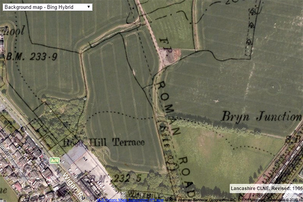
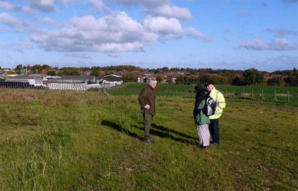
Our particular interest is, however, the Roman road and Andy Wilcock has recently been looking at LiDAR images of the area and has identified a possible ridge with ditches on either side. This gave us the incentive to have another look at map overlays, to see exactly where the road is supposed to have run and if anything could be seen on the latest aerial photos. Along most of the line nothing can be detected on either Google Earth or Bing Maps. However on the section crossing the playing field on the south side of the site, a distinct brown patch can be seen on the projected line of the Roman road. This was the target of our visit last month along with the features identified on the LiDAR images. It was a fine sunny day and having made our way across the playing field we entered the fields overlooking the Landgate valley. Drainage ditches were evident on either side of the suspected line, but a bank or 'agger' could not be detected. Most of the ground is uneven due to ploughing and it would be difficult to do a GPR survey. On our return however we noticed the playing field was perfectly flat presenting an ideal subject for a geophysics survey (we also looked for the brown patch shown on the aerial photo but none could be seen). Hopefully in the near future we will be able arrange something here to confirm the line of the Roman road. Although this would not stop any planned development, it would at least add more weight for it to be excavated and recorded before the evidence is lost forever.
Next Meeting
Wednesday 7th December. - This month it is our Christmas meal at the Brocket (which you need to have booked for). Please note the starting time is 7.00pm. If you have not booked for the meal, you can still come to the quiz night after the meal (the quiz will start around 8.00pm). Hope to see you then - BA
|