
| No.267 March 2024 | Monthly Newsletter |
Aspull Ring Ditch Coring Survey |
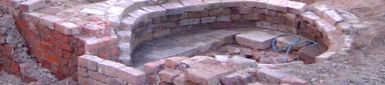
 A combination of good weather and the availability of Chris Drabble's Border Heritage Archaeology Group has provided us with an opportunity to do some coring on our site this early in the season. We had always planned to do the east quadrant, which would follow on from last year's coring exercise in the south quadrant. Coring, although not definitive, gives us a good idea where the ditch exists and where it doesn't. Last time it showed that the ditch seemed to be continuous in the south quadrant - albeit with one or two areas where there may be interruptions similar to the one in Trench 5 / 5a. Our approach this time on the east quadrant was slightly different. Instead of traversing the ditch at 1m intervals, which was very time consuming, we did one long scan south to north along a line that theoretically would dip in and out of the ditch. The thought was that this would reveal our main aim i.e. was there an entrance on the east side (similar to the one on the west - a typical arrangement for a henge monument). The result seemed to show that, as in the south quadrant, the ditch was continuous (i.e. no sign of an entrance) and more or less where we had predicted it to be. Also, as before though, there were a couple of areas where there may be an interruption in the ditch. Only excavation would prove this which we will do if we get the chance (full details as usual on our Blog).
Mosley Common Roman RoadThe Roman road between Manchester and Wigan has been generally accepted over the years but it does rely heavily on Sibson's early 19th century survey (which is depicted on the 1860s version on the 6 inch OS map). It seems though that this might not be completely correct in every place. David Ratledge has revisited the route using his LiDAR enhancing technique and has discovered what he believes to be the route across Mosley Common - and it isn't on the line depicted on the early OS map (or Sheep Lane as was claimed in the 1950's). On David's website, dealing with this road, his LiDAR image shows a ridge running across the Common on a line further south from previously accepted one (missing Sheep Lane altogether). Looking at the site on the version of LiDAR provided by the House Prices website (see below), with a bit of manipulation, a ridge can just about be seen.  Despite previous assurances (see Newsletter 247) this site is subject to be redeveloped and is currently in the planning process. Both David and I therefore have contacted GMAAS to make sure they are aware of this new line. Ian Miller has responded to say that he has placed an archaeological condition on the planning application so I'm confident this road will now not be missed if and when evaluation trenches are put in. This new line also has implications for the route going past Cleworth Hall (mentioned in last month's Newsletter 266). The revised projected line from Mosley Common now passes further south from the line shown on the early OS map, in fact missing the farmer's field altogether. The line now seems to follow the footpath which skirts around the north side of the housing estate, on the east side of Cleworth Hall Lane. Unfortunately, Jim Meehan's recent research has revealed that this area was subject to opencast mining just after the War, so it's unlikely that anything of the road has survived.  Next MeetingWednesday 6th March - at the Real Crafty on Upper Dicconson Street starting at 7.30pm as usual. This month we will be having Peter Noble from Glossop Archaeology Society talking about their investigations of a group of Bronze Age burial cairns in NW Derbyshire area. This is quite relevant to our current work at Aspull, although the form and structure of their funerary sites seem to be quite different to ours. He is an excellent speaker and it's a very interesting talk so hope to see you there - BA. |