Arley Golf Course Development
|
|
As reported in Newsletter 23, the golf course at Arley has now been extended to 18
holes. To comply with PPG16 regulations, evaluation trenches were dug prior to
construction work, to check the extent of any archaeological remains. This task was
carried out by Lindsey Archaeological Service (LAS) of Lincoln, who completed the work in
July last year. It may seem strange to employ a southern group to do this work, until you
realise the contractors, Gaunt & Marnoch, also come from the Lincoln area. I have now
received their report and it makes interesting reading.
Here are the details.
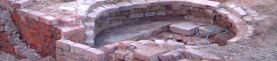
Disturbance
Trench 1
|
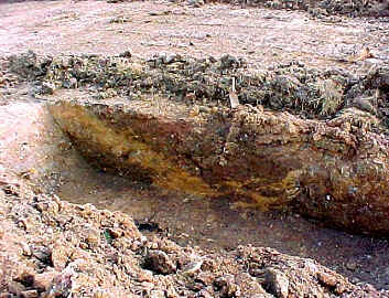
Two trenches were machine-cut into the underlying clay, each 1.8m by 25m long.
The location was selected at the northern edge of the field to provide possible evidence
for Iron Age or Roman-British settlement. These settlements are typical of promontory
positions such as this, although they are more usually found on gravel sub-soils. The
evidence from the excavations, however, was of extensive disturbance, with little or no
evidence of occupation layers. This could be the result of either surface mining activity
or the construction of the nearby Arley reservoirs.
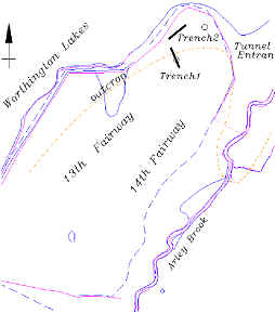
Arley Golf Course
Trench Location Map
|
Layers of dumping were observed, in some places to a depth of over 1.5m. In
trench 1 a mineshaft was detected 5.15m in diameter, cutting vertically through this
re-deposited material. This is unusual in ground that tends to be less stable, implying
that the disturbances were much earlier. LAS suggest that it may have occurred as early as
14th or 15th century when coal could be extracted from near the
surface. The geology map shows the Arley seam outcropping all along this ridge, which
would be very attractive to early prospectors. LAS also suggested that the vertical shafts
could be the capped airshafts from the River Douglas culvert, which was dug in the 1850s.
Interpretation
Tim McAvoy and myself examined the site soon after the excavations had been completed
(but not back filled). We noticed that developers had stripped away the topsoil from the
whole field, revealing a number of mineshafts in the excavation area. These were too close
together to be capped airshafts and must therefore represent later mining activity. As
mentioned in the previous newsletter, our interest in this field, centres on the
possibility of Roman mining activity, as reported by Edward Hull, the 19th
century government inspector. Our interpretation, therefore, is that this disturbance may
well be a lot earlier than the Middle-ages. No early dating material, however, came out of
the excavations, but opinions that the promontory is an artificial build-up, suggest that
the evidence could still be buried deep below the present surface.
Next Meeting
Wednesday 1st November at the BP Centre (Scout HQ) in Greenough Street, at 7.30 pm as
usual. This month’s speaker is Dr Tim Strickland, who is the Regional Chairman of the
CBA North West (Council for British Archaeology). He will be talking on ‘Roman
influences in Armenia’
Hope to see you there - B.A. |