
After some rearranging, we managed to get Trevor Boardman to take us out last month on a short tour of Borsdane Wood. Trevor had previously mentioned that there were some strange and puzzling features in the wood that perhaps we weren’t aware of and maybe we could suggest an explanation for. Having grown up in Hindley, I thought there was little I didn’t know about the wood and I was therefore intrigued and perhaps a little sceptical about what Trevor was claiming. As our group assembled at the Hindley end of the wood in front of the tunnels, Trevor immediately began to tell us what he thought of them. Controversially he was suggesting that far from being the masterpiece of Victorian engineering we all admired, it was a botch job in his opinion with changes of design having to be made throughout its construction.
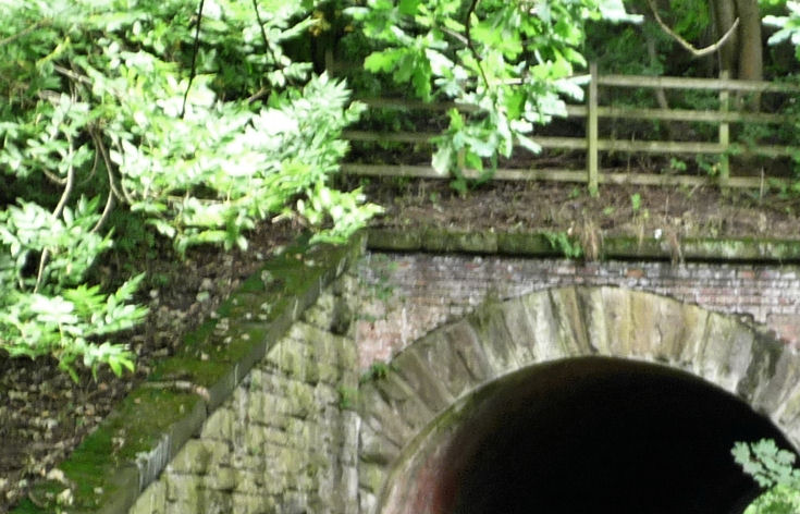 His first evidence was the capping stones running along the top of the entrance’s parapet. On the right side the stones curve round to form a smooth interface with the side wall. On the left side however the stones abruptly disappear behind the huge stone buttress. Trevor suggests this wall had to be added at a later date to prevent the steep embankment from collapsing the brick parapet. He also suggests that the second huge stone buttress was added between the tunnels once again to shore up the brick wall in the centre of the two tunnels. It is true that these buttresses are not integrated into the wall but lie up against it.
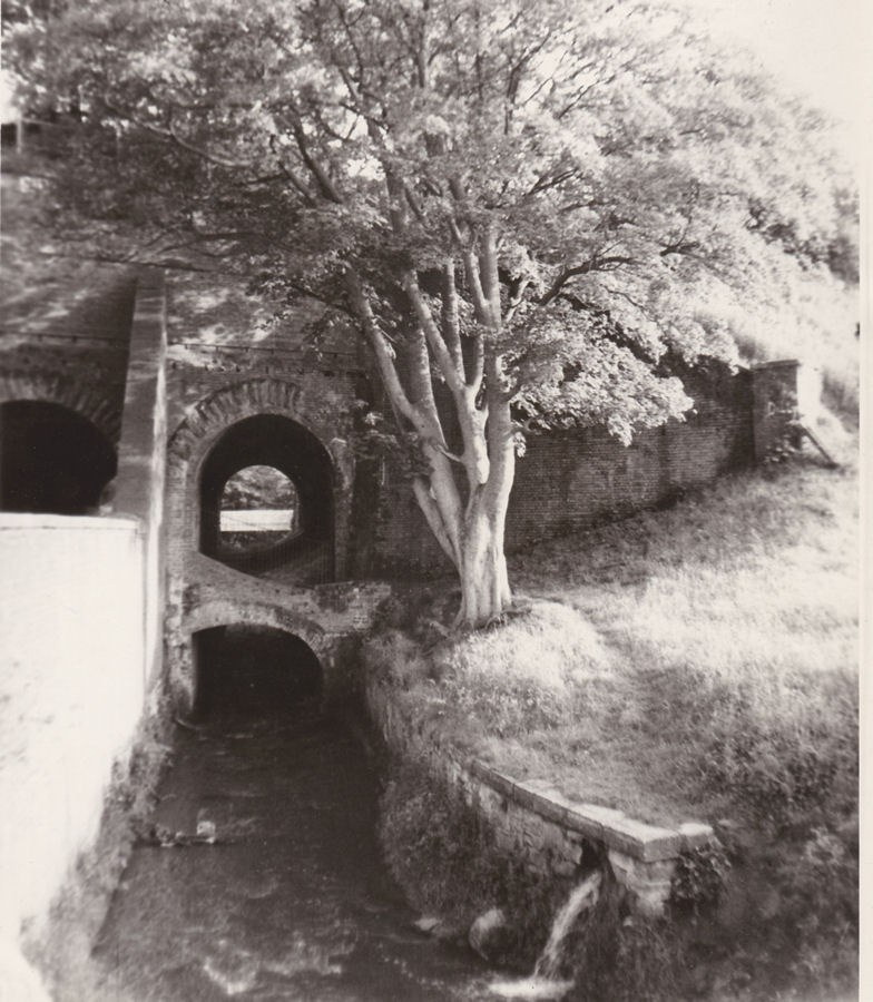 (View of the tunnels from the late 70’s.)
Trevor’s second piece of evidence was the arrangement of brick buttresses which span down the length of the river tunnel keeping the walls apart. These are irregular in width and position suggests they were added later perhaps when realising the walls needed shoring, perhaps replacing temporary wood baulks put in as the tunnel built up. Trevor reasons that a tunnel this high would normally be a figure of eight design or perhaps a series of arches on top of each other as the Romans did with their aqueducts. This arrangement looks like they just hadn’t thought it through.
Lastly Trevor pointed to the wall on the wood side of the tunnel with its irregular construction again suggest changes during the building phase. This time the parapet wall and buttresses are made from blue engineering brick which is stronger and more water resistant. The left hand buttress has horizontal courses whereas the central buttress courses are at 45 degrees. It also looks like the parapet wall has been heightened leaving a row of capping stones in-situ at a lower level.
Not knowing the full history of its construction it’s difficult to say whether Trevor is right, maybe the tunnel was extended on this side at a later date to accommodate an extra line. I do know that the line was started in 1845 and initially called the Liverpool and Bury Railway. By the time it was finished in 1848 it had changed its name to the Lancashire and Yorkshire Railway. Whether you agree with Trevor or not the tunnels seem to me to be quite a feat of engineering for their day and still in working condition after 170 years.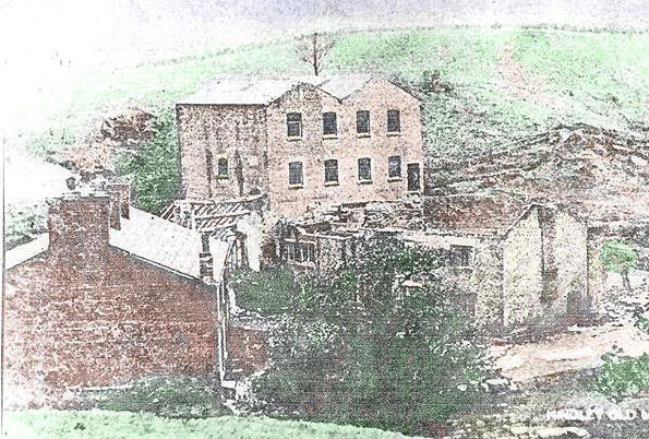 Next Trevor took us to look at the site of the cotton mill that was demolished soon after the turn of the 19th century. In its day it had both water and steam power with a large mill pond to the north which is still evident. The mill site itself if completely overgrown but I remember an excavation there in the mid 60’s carried out I think by pupils from Argyll Street School. They uncovered huge stone machine beds which I presume are still there but may well be buried under wash from the adjacent hillside.
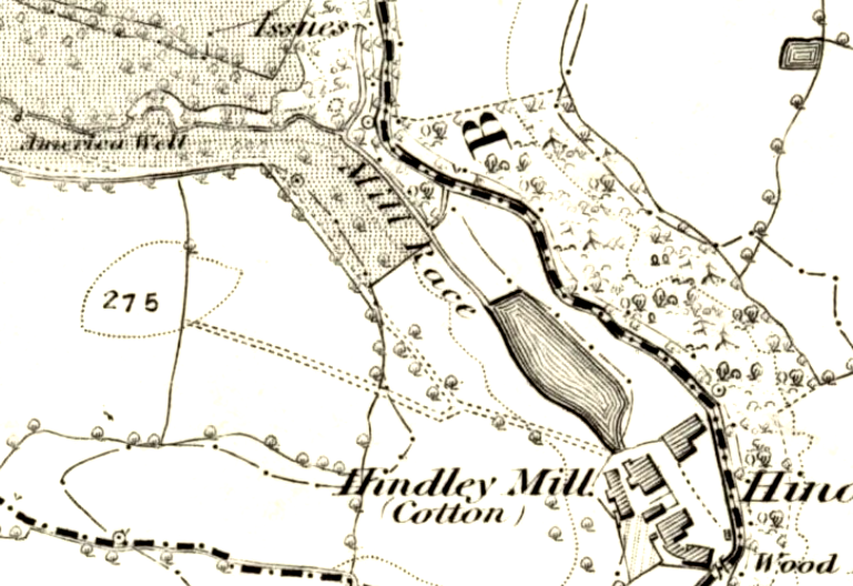 6 inch OS map of 1849
Trevor was keen to explain how the mill pond was fed with water and so a little further into the wood he showed us the remains of the leat or race leading off to the north of the pond. However as this ditch approaches the path it disappears, so where did the water come from? Trevor took us along the path to a culvert passed under the footpath taking water from a small valley leading off to the left. He told us to examine the small valley and see if we could spot anything. 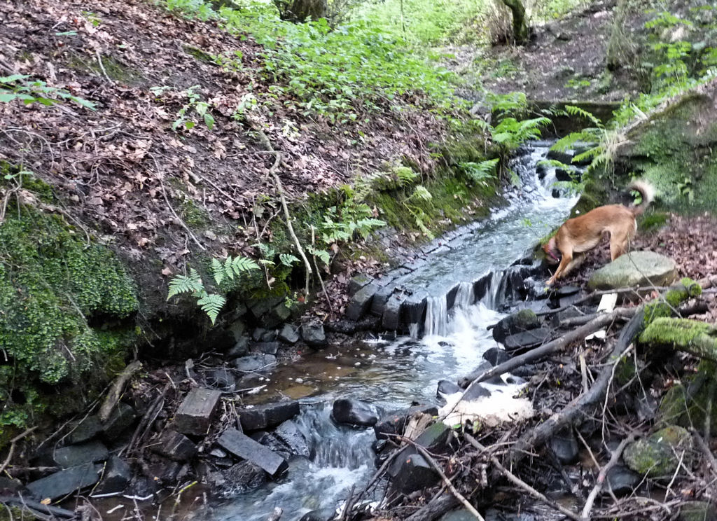 Sure enough in the stream bed were loose bricks and little further up we could see the source, the remains of a brick-lined culvert, the head of which was the remains of a small dam. Trevor’s contention is that this stream was the source of the water for the mill pond. This seems quite feasible as the stream actually comes all the way from Hall Lane where there is a reservoir in the grounds of Hindley Hall. Trevor says this was used to store water ready to fill the mill pond when needed.
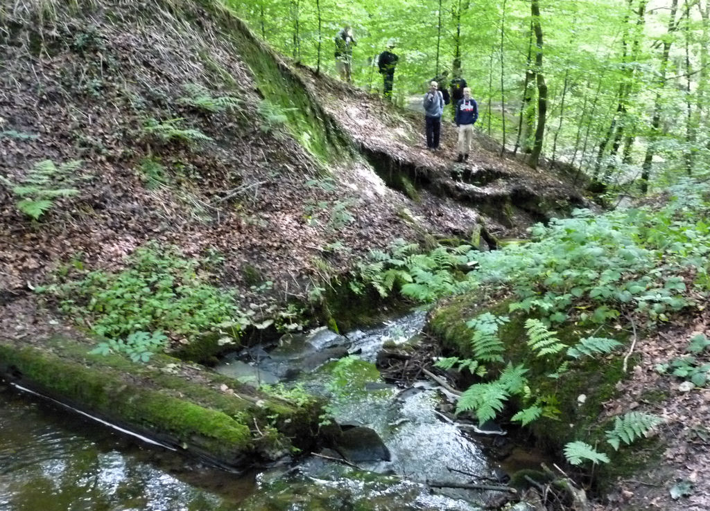 I was quite surprised by this as I always thought that the water came from Borsdane Brook as there is the weir at a place we always referred to as Flag Bottom. However how the water got from the weir to the mill pond is not very obvious and landscaping in the 80’s has made it impossible to find out.
 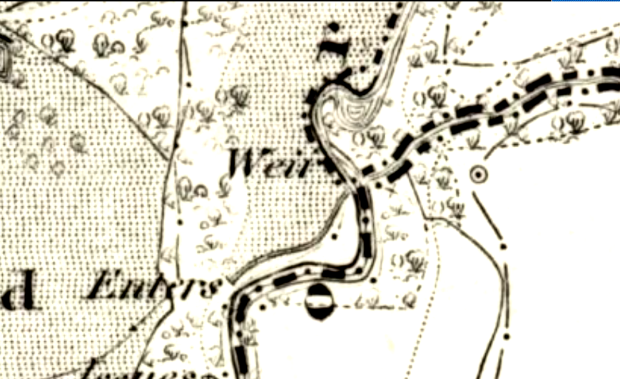 The 6 inch OS map of 1849 however does show the leat going all the way back to the weir, albeit through a tunnel. I seem to remember the entrance to a square shaped stone-lined tunnel on the west bank of the Brook but all traces have now disappeared due to the landscaping. The OS map shows Trevor’s stream running into the leat as well as a stream from the opposite bank. It seems obvious therefore that the mill pond was fed by a sophisticated water management system designed to maintain a constant supply which is need to keep the mill wheels working through all weather conditions.
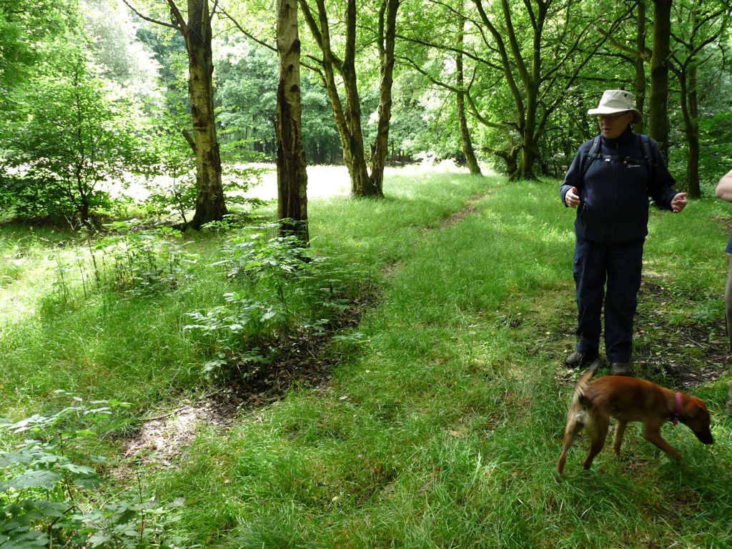 The last site Trevor took us to was located on the other side of the Brook where the trees open up into a clearing of level ground. As a child I played in this field many times but never spotted the next think Trevor pointed out to us. Running the full length of the field from north to south we could see parallel ditches approximately 4.5 metres apart. The field is not as clear as I remember it and was probably completely devoid of trees not that long ago. The ditches seem to be part of some field system but I’ve no idea what age. Medieval ridge and furrow is quite rare in this part of the country and usually has a slight ‘S’ shaped curve to it.
 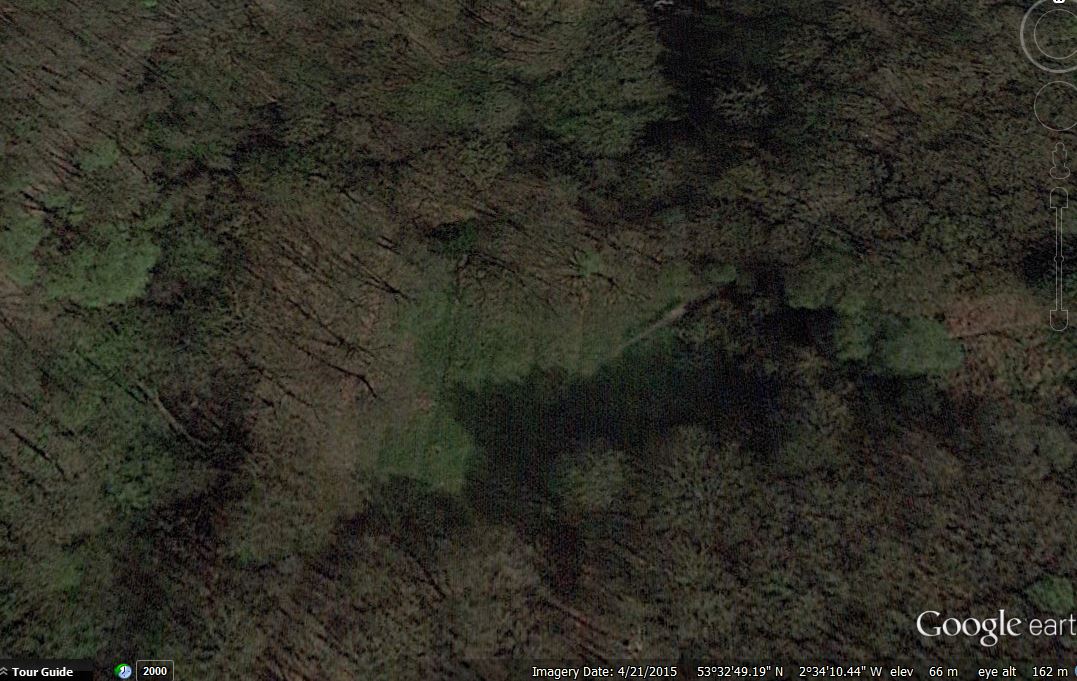 These ditches are completely straight with little or no ridge in between. Very similar field systems can be seen in other parts of our region. In fact when investigating the line of the Roman road in Standish we came across exactly the same pattern in fields between Wakefield’s Farm and Roundmoor farm.
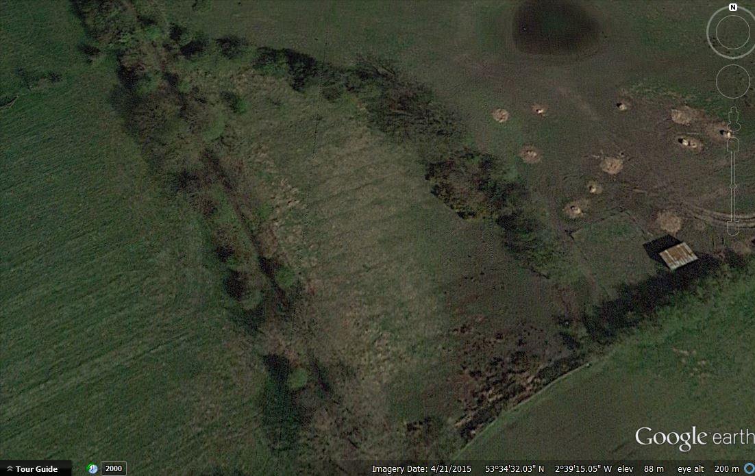 This was a great trip and Trevor has certainly left us with some interesting questions which hopefully we’ll be able to answer in the near future.
Thanks this was a great article. I remember playing in these woods, growing up as a kid on Smithwood Ave.
Flag bottom… how could I possibly forget that!
Glad you liked it Gerry – here are a couple more websites you may be interested in:
Memories of Hindley
https://www.facebook.com/groups/708121822542872/?fref=nf
Borsdane Friends Group
http://borsdanewoodsfriendsgroup.co.uk/
Bill
There were similar parallel lines in the fields on the South side of Pepper Lane , Standish . I mentioned them to my history teacher (40 odd years ago) and was told very dismisfully that they would be field drains. I will try and check before the developers start work.
Hello, I have long been interested in the industrial archaeology of Borsdane Wood, ever since I was a lad who lived just outside the wood in Danes Avenue. I had been told about the old mill and the cottages next to it and I saw the large stone slabs covering what looked like cellars. You could get into them at one point. I knew about the old mill lodge nearby. In the 60’s there was a couple of feet of water in it in winter but now it is dry all year round.
I had seen the remains of the mill race, the dam in the America Wood brook and the culverted stream coming down from the golf course pond. I realized, being a bit of an amateur geologist, that the Flag Bottom wasn’t a natural waterfall, but was manmade.
It wasn’t until much later when I was working as a Mine Surveyor for the NCB that I had chance to study the 1849 OS map that I put two and two together and realized what I was looking at.
Now that I am retired and have a bit more time on my hands, I have started to try and find out more about the mill, millrace, weir etc.
You can actually see quite a bit more of the remains of the millrace in the stretch between the flag bottom and where the race entered the short tunnel. It is very distinct.
With regards to the tunnel, I crawled along it when I was a lad. It had a stone flag sole, sides and roof. The roof had collapsed about two thirds of the way along, so I retreated. The things you do when you are a kid!!!
Of course, the tunnel was destroyed when the council landscaped the bank side in the early 1970’s to create the present footpath.
I see above that you mention the Memories of Hindley facebook page. I am one of the admin on that page and I have posted a few things about the wood on there among other things.
Hi Chris – good to hear from you. I too remember the tunnel but didn’t know what it was for (didn’t have the courage to go in it either). On our recent trip we did see evidence for the mill race down stream from Flag Bottom but couldn’t work out how the water got from the dam (and the map isn’t very clear).
I also remember the stone foundations of the mill which I presume are still there. We did consider the possibility of carrying out an excavation to see if we could find them again but I’m guessing they would be quiet well buried by now and also getting permission from the council could be a problem – but maybe worth a try in the future .
Hi Bill, yes the map isn’t too clear. it appears to show the stream on the opposite side going straight into the mill race. It may well have done so. However, I reckon that the water level upstream of the weir/waterfall would have been raised by having a timber structure built on top of the weir. There would have been holes in the top of the weir into which timber uprights were fixed and then planks placed horizontally across these to dam the brook up to the level of the mill race. These holes have long been eroded away but about 30 yds downstream in the stream bed there is a piece of stone with a hole in it which could be one of the holes for the upright timbers.
I would have crawled all the way through the tunnel if it hadn’t been blocked. I contemplated going up the other tunnel, the culvert in America wood but never got round to it. All this wanting to crawl up tunnels must have been in preparation for my career as a mine surveyor! I even opened up my own coal mine at the front of our home in Danes Avenue when I found a 4ft thick coal seam outcropping in the clay bank of the brook.
Now that I have a bit more time on my hands I intend to try and find out more about the old mill and it’s history. All I have seen so far is the 1849 map and the photo.
That is when I am not researching into my other two projects, the history of my house which is at least 200 yrs old and trying to find more about Castle Hill Colliery.
Keeping busy.
Hi Chris – my dad always said there was a pit under the end terrace at the bottom of Close Street – looking at the 1949 OS map it looks like he was right (hope they capped it well). My mother was brought up in a cottage at the back of what she called Castle Croft (which is marked as Bull Inn on the old map). I’ve always been fascinated by the name Castle Hill – was there ever a castle? My dad said it was a large house on the edge of the Sand Pit (marked as Hill Top on later maps). I remember the foundations – steps going down into a cellar (which we assumed was haunted). My dad recollects it being pulled down (looks like it’s all been re-landscaped so probably not much chance of finding anything there now).